
Magnitude |
:2.7 |
| Date & Time (UTC) | 2013-02-23 21:18:06.3 |
| Date & Time (Local) | 1391/12/6 00:48:06.3 |
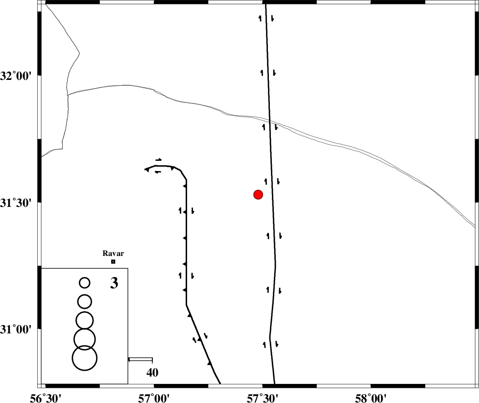
| Location | Lat:31.53 Lon: 57.48 |
| Region | Kerman Province, 70 km North-East of Ravar |
Nearest Cities |
|
| 69 km North East of Dehali, Kerman Province | |
| 70 km South of Hoz-e qorban, Yazd Province | |
| 70 km North East of Ravar, Kerman Province | |
| 98 km North East of Hejdak, Kerman Province | |
| 99 km North East of Ahmadi, Kerman Province | |
| Depth | 14 km |
| Agency | |
Faults within 150 km: |
|
| NAYBAND_F (Length: 258 km) , Distance to epicenter: 21 km | |
| LAKARKUH_F (Length: 138 km) , Distance to epicenter: 32 km | |
| GOLBAF_SIRCH_F (Length: 114 km) , Distance to epicenter: 106 km | |
| Number of Phases | 5 |
| RMS | 0.1 |
| Number of Stations | 3 |
| Error in Latitude | >1.3 km |
| Error in Longitude | 7.2 km |
| Error in Depth | 4.1 km |
Download waveform in seisan format
to download seisan software Click here
to access information about IIEES stations Click here
Amplitude | ||||||||
| UID | Agency | Station | Component | Amplitude | Period | Arrival Time | Proccessing Time | Signal Clip |
| 88011 | IIEES | KRBR | E | 86.7 | 0.32 | 2013-02-23 21:19:06 | 2013-02-24 12:19:00 | n |
Phase | ||||||||||||
| Agency | Station | Component | Phase Type | Phase Quality | First Motion | Observed Arrival Time | Time Residual | Loc. Flag | Input Weight | Distance | Azimuth | |
| IIEES | KRBR | Z | Pn | E | 2013-02-23 21:18:37 | 0.19 | y | 185 | 202 | |||
| IIEES | KRBR | N | Sg | E | 2013-02-23 21:18:59 | -0.15 | y | 185 | 202 | |||
| IIEES | TABS | Z | Pn | E | 2013-02-23 21:18:43 | -0.1 | y | 237 | 352 | |||
| IIEES | TABS | E | Sg | E | 2013-02-23 21:19:13 | -0.03 | y | 237 | 352 | |||
| IIEES | YZKH | Z | Pn | E | 2013-02-23 21:18:50 | 0.1 | y | 289 | 290 | |||