
Magnitude |
:4 |
| Date & Time (UTC) | 2013-02-22 01:39:24.4 |
| Date & Time (Local) | 1391/12/4 05:09:24.4 |
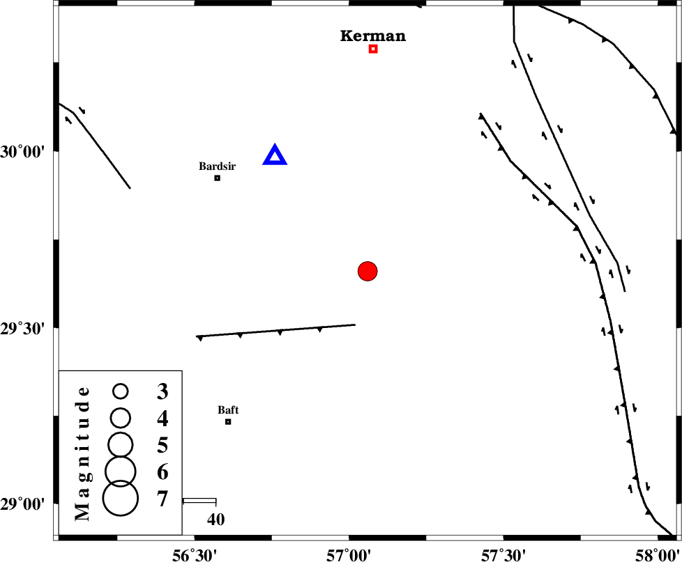
| Location | Lat:29.66 Lon: 57.06 |
| Region | Kerman Province, 70 km South of Kerman |
Nearest Cities |
|
| 28 km North East of Lalehzar, Kerman Province | |
| 33 km South East of Negar, Kerman Province | |
| 37 km North West of Rain, Kerman Province | |
| 38 km North East of Siyah bonueyeh, Kerman Province | |
| 41 km North East of Ghale-ye asgar, Kerman Province | |
| Depth | 16 km |
| Agency | |
Faults within 150 km: |
|
| LALEHZAR_F (Length: 52 km) , Distance to epicenter: 17 km | |
| GOWK_F (Length: 152 km) , Distance to epicenter: 57 km | |
| GOLBAF_SIRCH_F (Length: 114 km) , Distance to epicenter: 72 km | |
| Number of Phases | 8 |
| RMS | 0.3 |
| Number of Stations | 7 |
| Error in Latitude | >5.3 km |
| Error in Longitude | 4.5 km |
| Error in Depth | 8.6 km |
Download waveform in seisan format
to download seisan software Click here
to access information about IIEES stations Click here
Amplitude | ||||||||
| UID | Agency | Station | Component | Amplitude | Period | Arrival Time | Proccessing Time | Signal Clip |
| 87984 | IIEES | YZKH | E | 354.5 | 0.48 | 2013-02-22 01:41:20 | 2013-02-22 02:03:00 | n |
| 87985 | IIEES | TABS | N | 237.2 | 0.52 | 2013-02-22 01:41:48 | 2013-02-22 02:03:00 | n |
| 87986 | IIEES | AHRM | N | 73 | 0.48 | 2013-02-22 01:41:45 | 2013-02-22 02:03:00 | n |
Phase | ||||||||||||
| Agency | Station | Component | Phase Type | Phase Quality | First Motion | Observed Arrival Time | Time Residual | Loc. Flag | Input Weight | Distance | Azimuth | |
| IIEES | KRBR | Z | Pg | E | 2013-02-22 01:39:32 | -0.07 | y | 46 | 321 | |||
| IIEES | KRBR | N | Sg | E | 2013-02-22 01:39:39 | 0.06 | y | 46 | 321 | |||
| IIEES | ZHSF | Z | Pn | E | 2013-02-22 01:40:16 | -0.24 | y | 360 | 90 | |||
| IIEES | YZKH | Z | Pn | E | 2013-02-22 01:40:19 | -0.66 | y | 384 | 323 | |||
| IIEES | GHIR | Z | Pn | E | 2013-02-22 01:40:25 | 0.23 | y | 426 | 250 | |||
| IIEES | TABS | Z | Pn | E | 2013-02-22 01:40:27 | 0.35 | y | 442 | 1 | |||
| IIEES | SHRT | Z | Pn | E | 2013-02-22 01:40:39 | 0.39 | y | 537 | 34 | |||
| IIEES | AHRM | Z | Pn | E | 2013-02-22 01:40:42 | 0.13 | y | 567 | 262 | |||