
| Prel. Rep. | Date | Time(UTC) | Time(Local) | Lat. | Lon. | Depth | Mag. | Region | Waveform |
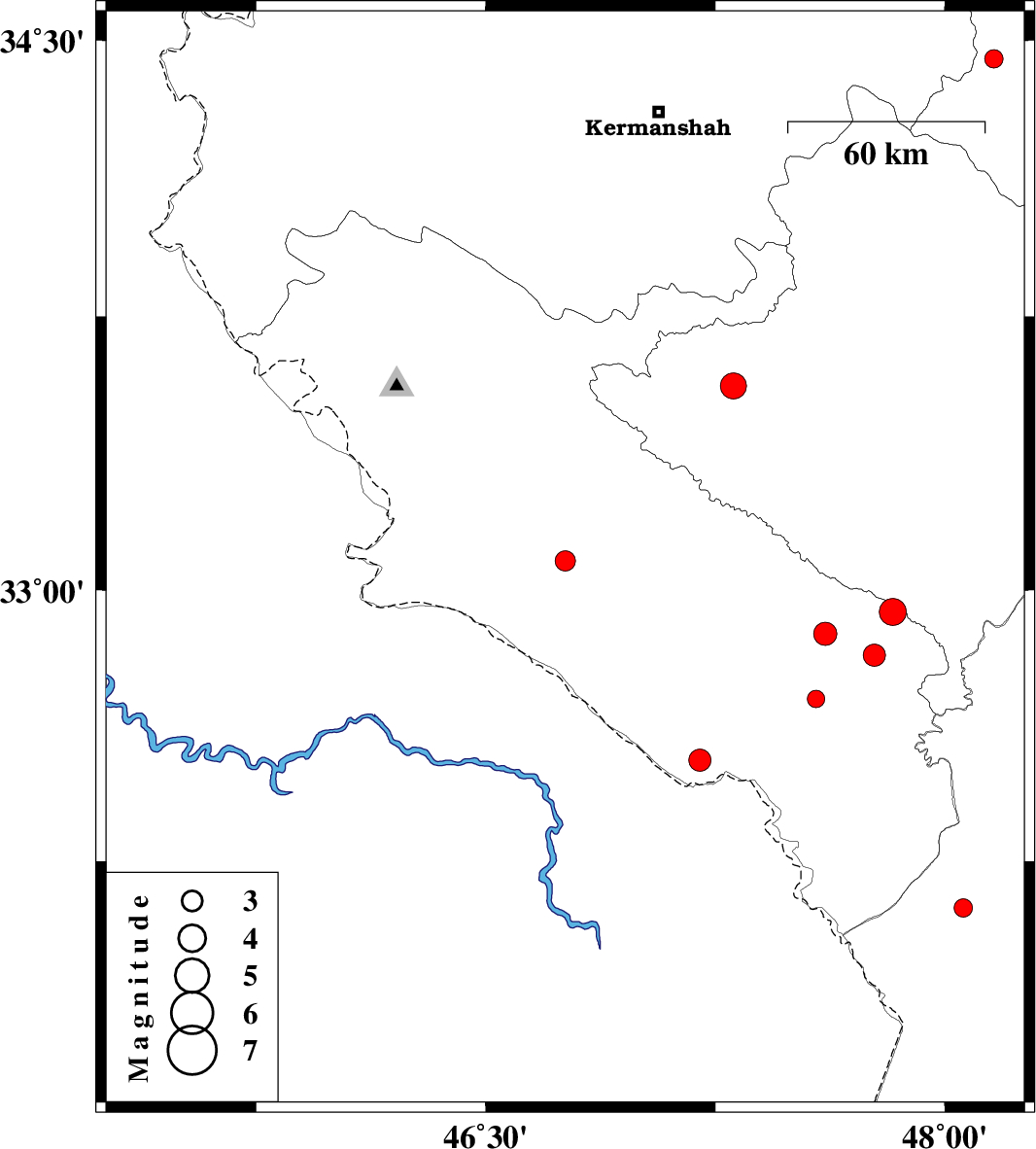
| 2012/09/23 | 05:09:39.8 | 08:39:39.8 | 33.08 | 46.76 | 42 | ML:2.9 | Ilam Province, 51 km West of Darreh Shahr | ||
| 2012/09/22 | 04:07:28.4 | 07:37:28.4 | 32.53 | 47.2 | 14 | ML:3.2 | Ilam Province, 19 km South of Dehloran | ||
| 2012/09/22 | 03:52:39.6 | 07:22:39.6 | 34.45 | 48.16 | 31 | ML:2.7 | Hamedan Province, 21 km East of Kangavar | ||
| 2012/09/19 | 11:59:40.4 | 16:29:40.4 | 33.56 | 47.31 | 14 | ML:3.8 | Lorestan Province, 28 km West of Kuhdasht | ||
| 2012/09/16 | 21:29:16.7 | 01:59:16.7 | 32.12 | 48.06 | 18 | ML:2.7 | Khoozestan Province, 20 km West of Shush | ||
| 2012/08/29 | 12:46:59.7 | 17:16:59.7 | 32.82 | 47.77 | 15 | ML:3.2 | Ilam Province, 38 km South of Pol-e dokhtar | ||
| 2012/08/29 | 12:22:59.3 | 16:52:59.3 | 32.94 | 47.83 | 14 | ML:4 | Ilam Province, 27 km South-East of Pol-e dokhtar | ||
| 2012/08/28 | 06:24:19.0 | 10:54:19.0 | 32.88 | 47.61 | 14 | ML:3.4 | Ilam Province, 15 km East of Abdanan | ||
| 2012/08/25 | 09:23:14.6 | 13:53:14.6 | 32.7 | 47.58 | 18 | ML:2.5 | Ilam Province, 30 km East of Dehloran |