
Magnitude |
:2.7 |
| Date & Time (UTC) | 2012-09-16 21:29:16.7 |
| Date & Time (Local) | 1391/6/27 01:59:16.7 |
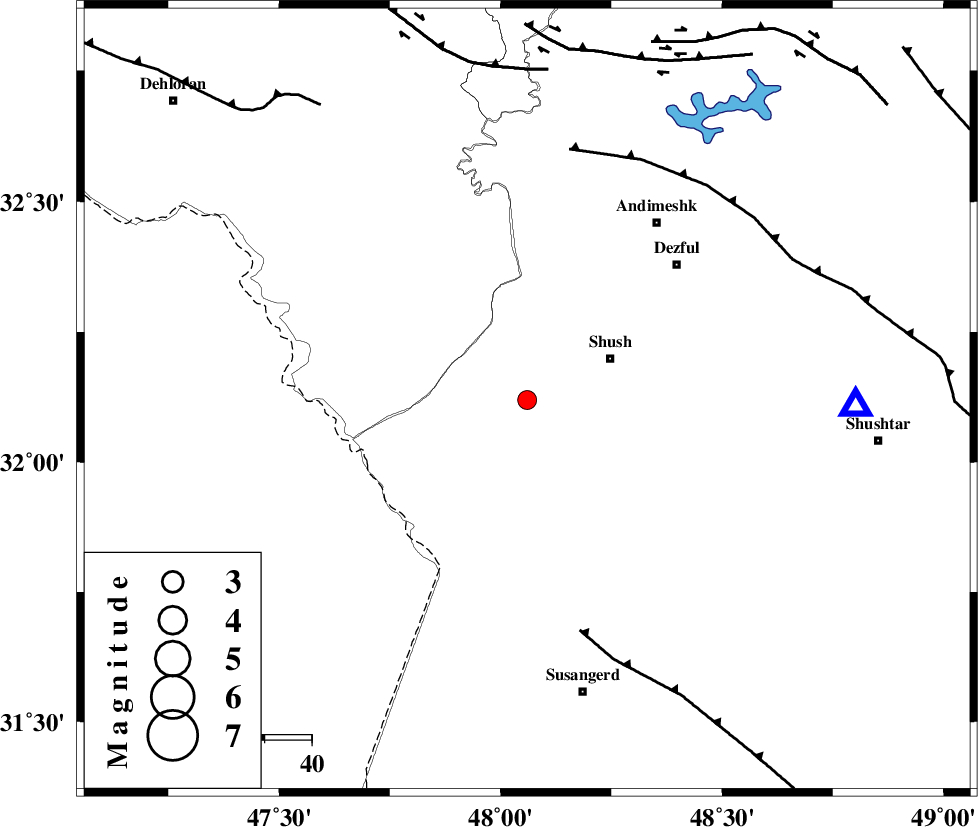
| Location | Lat:32.12 Lon: 48.06 |
| Region | Khoozestan Province, 20 km West of Shush |
Nearest Cities |
|
| 20 km West of Shush, Khoozestan Province | |
| 22 km West of Amaleh teimur, Khoozestan Province | |
| 40 km South West of Shamsabad, Khoozestan Province | |
| 43 km South West of Dezful, Khoozestan Province | |
| 45 km North of Bostan, Khoozestan Province | |
| Depth | 18 km |
| Agency | |
Faults within 150 km: |
|
| AHVAZ_F (Length: 99 km) , Distance to epicenter: 51 km | |
| DEZFUL_EMBAYMENT (Length: 228 km) , Distance to epicenter: 54 km | |
| BALARUD_F_Z1 (Length: 87 km) , Distance to epicenter: 71 km | |
| Number of Phases | 6 |
| RMS | 0.1 |
| Number of Stations | 5 |
| Error in Latitude | >2.3 km |
| Error in Longitude | 4.1 km |
| Error in Depth | 4.6 km |
Download waveform in seisan format
to download seisan software Click here
to access information about IIEES stations Click here
Amplitude | ||||||||
| UID | Agency | Station | Component | Amplitude | Period | Arrival Time | Proccessing Time | Signal Clip |
| 86152 | IIEES | SHGR | N | 373.1 | 0.76 | 2012-09-16 21:29:49 | 2012-09-16 09:40:00 | n |
| 86153 | IIEES | SHGR | E | 417.3 | 0.52 | 2012-09-16 21:29:53 | 2012-09-16 09:40:00 | n |
Phase | ||||||||||||
| Agency | Station | Component | Phase Type | Phase Quality | First Motion | Observed Arrival Time | Time Residual | Loc. Flag | Input Weight | Distance | Azimuth | |
| IIEES | SHGR | Z | Pg | E | 2012-09-16 21:29:28 | 0 | y | 69.6 | 90 | |||
| IIEES | KHMZ | Z | Pn | E | 2012-09-16 21:29:55 | 0.1 | y | 253 | 44 | |||
| IIEES | KHMZ | E | Sg | E | 2012-09-16 21:30:28 | 0 | y | 253 | 44 | |||
| IIEES | ASAO | Z | Pn | E | 2012-09-16 21:30:04 | -0.09 | y | 326 | 34 | |||
| IIEES | SNGE | Z | Pn | E | 2012-09-16 21:30:06 | 0.02 | y | 337 | 349 | |||
| IIEES | GHVR | Z | Pn | E | 2012-09-16 21:30:13 | -0.06 | y | 396 | 48 | |||