
| Prel. Rep. | Date | Time(UTC) | Time(Local) | Lat. | Lon. | Depth | Mag. | Region | Waveform |
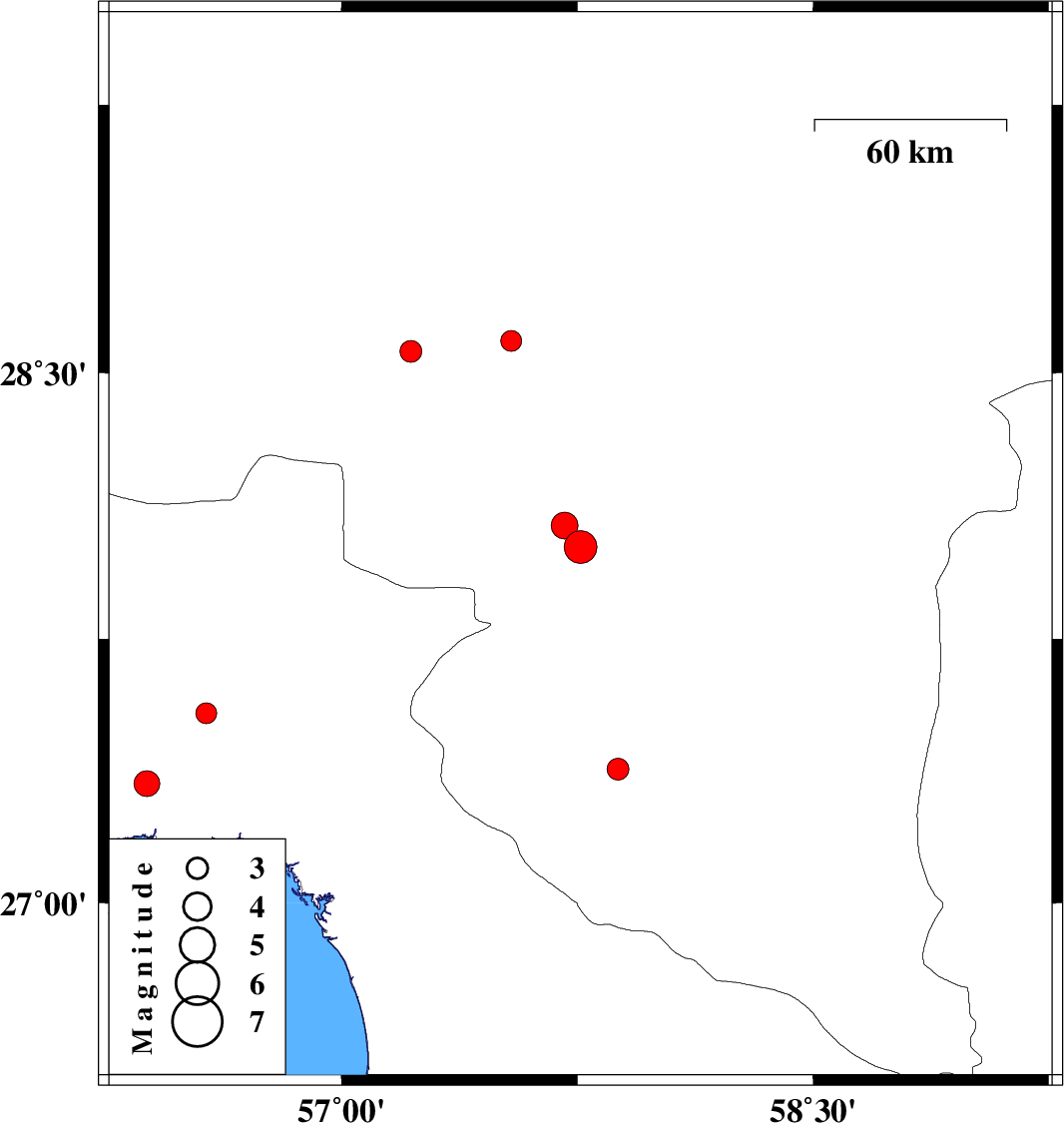
| 2012/09/03 | 03:03:41.9 | 07:33:41.9 | 28.01 | 57.76 | 14 | ML:4.7 | Kerman Province, 10 km Kahnuj | ||
| 2012/08/31 | 09:30:46.1 | 14:00:46.1 | 27.54 | 56.57 | 14 | ML:3 | Hormozgan Province, 49 km North-East of Bandar-e abbas | ||
| 2012/08/19 | 06:38:08.3 | 11:08:08.3 | 27.38 | 57.88 | 18 | ML:3.1 | Kerman Province, 38 km East of Manujan | ||
| 2012/08/18 | 14:46:32.0 | 19:16:32.0 | 28.56 | 57.22 | 35 | ML:3.1 | Kerman Province, 52 km South-West of Jiroft | ||
| 2012/08/11 | 11:14:21.7 | 15:44:21.7 | 28.07 | 57.71 | 30 | ML:3.8 | Kerman Province, 14 km North of Kahnuj | ||
| 2012/08/10 | 06:14:27.8 | 10:44:27.8 | 28.59 | 57.54 | 14 | ML:2.9 | Kerman Province, 21 km West of Jiroft | ||
| 2012/08/07 | 18:52:28.6 | 23:22:28.6 | 27.34 | 56.38 | 14 | ML:3.7 | Hormozgan Province, 19 km North of Bandar-e abbas |