
Magnitude |
:3.1 |
| Date & Time (UTC) | 2012-08-19 06:38:08.3 |
| Date & Time (Local) | 1391/5/29 11:08:08.3 |
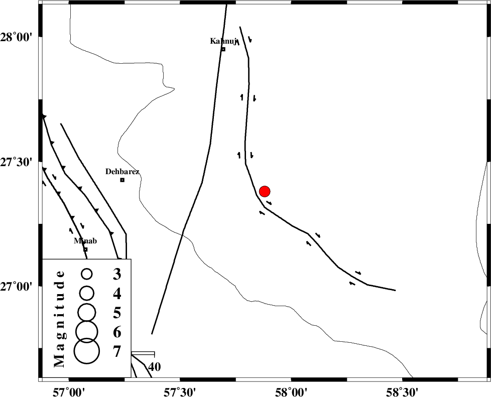
| Location | Lat:27.38 Lon: 57.88 |
| Region | Kerman Province, 38 km East of Manujan |
Nearest Cities |
|
| 16 km South of Qalehy-eganj, Kerman Province | |
| 30 km North of Keshmiran, Kerman Province | |
| 36 km South East of Bargah, Kerman Province | |
| 38 km East of Manujan, Kerman Province | |
| 47 km South East of Nodezh, Kerman Province | |
| Depth | 18 km |
| Agency | |
Faults within 150 km: |
|
| JIROFT_F (Length: 144 km) , Distance to epicenter: 4 km | |
| SABZEVARAN_F (Length: 190 km) , Distance to epicenter: 28 km | |
| ZENDAN_MINAB_F_Z1 (Length: 183 km) , Distance to epicenter: 65 km | |
| Number of Phases | 4 |
| RMS | 0.1 |
| Number of Stations | 3 |
| Error in Latitude | >8.2 km |
| Error in Longitude | 5.5 km |
| Error in Depth | 7.6 km |
Download waveform in seisan format
to download seisan software Click here
to access information about IIEES stations Click here
Amplitude | ||||||||
| UID | Agency | Station | Component | Amplitude | Period | Arrival Time | Proccessing Time | Signal Clip |
| 85581 | IIEES | BNDS | E | 287.7 | 0.36 | 2012-08-19 06:39:01 | 2012-08-19 07:11:00 | n |
| 85582 | IIEES | BNDS | N | 179.3 | 0.4 | 2012-08-19 06:39:07 | 2012-08-19 07:11:00 | n |
| 85583 | IIEES | KRBR | N | 66 | 0.2 | 2012-08-19 06:39:35 | 2012-08-19 07:11:00 | n |
| 85584 | IIEES | KRBR | E | 76.8 | 0.24 | 2012-08-19 06:39:38 | 2012-08-19 07:11:00 | n |
Phase | ||||||||||||
| Agency | Station | Component | Phase Type | Phase Quality | First Motion | Observed Arrival Time | Time Residual | Loc. Flag | Input Weight | Distance | Azimuth | |
| IIEES | BNDS | Z | Pg | E | 2012-08-19 06:38:36 | 0.11 | y | 169 | 271 | |||
| IIEES | BNDS | N | Sg | E | 2012-08-19 06:38:56 | -0.01 | y | 169 | 271 | |||
| IIEES | KRBR | Z | Pn | E | 2012-08-19 06:38:54 | 0.03 | y | 308 | 340 | |||
| IIEES | GHIR | Z | Pn | E | 2012-08-19 06:39:16 | -0.18 | y | 492 | 283 | |||