| Prel. Rep. | Date | Time(UTC) | Time(Local) | Lat. | Lon. | Depth | Mag. | Region | Waveform |
|
|
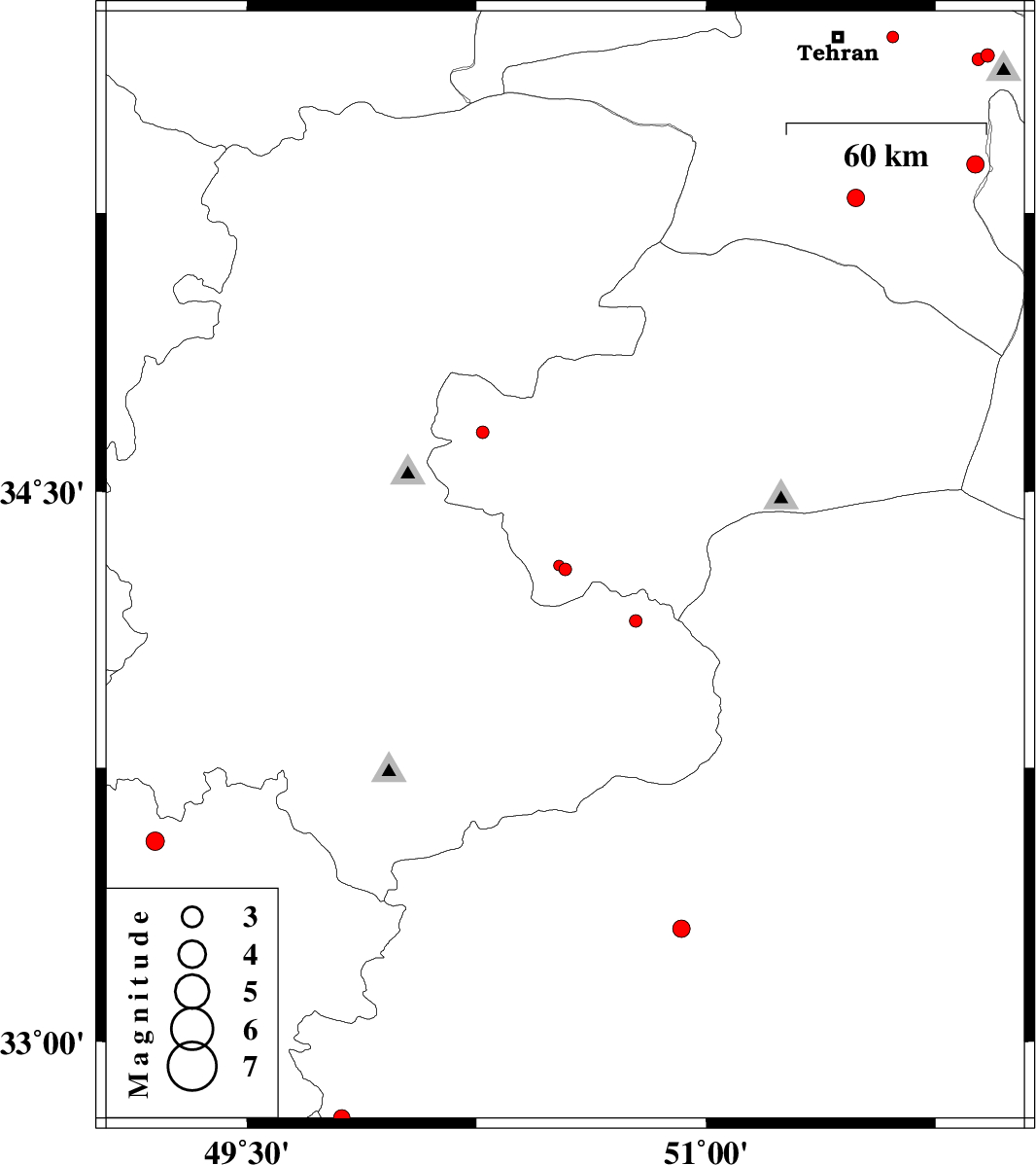
2012/08/16
|
15:03:26.1
|
19:33:26.1
| 34.29 | 50.54 | 14 |
ML:1.8
|
Qom Province, 36 km North-West of Delijan | |
|
|
2012/08/16
|
04:51:58.4
|
09:21:58.4
| 35.29 | 51.49 | 15 |
ML:2.5
|
Tehran Province, 17 km West of Varamin | |
|
|
2012/08/12
|
12:16:10.3
|
16:46:10.3
| 34.15 | 50.77 | 23 |
ML:1.8
|
Markazi Province, 19 km North of Delijan | |
|
|
2012/08/09
|
09:16:17.2
|
13:46:17.2
| 34.3 | 50.52 | 18 |
ML:1.6
|
Qom Province, 43 km North of Mahallat | |
|
|
2012/08/09
|
08:01:31.8
|
12:31:31.8
| 35.72 | 51.61 | 31 |
ML:1.7
|
Tehran Province, 17 km East of Tajrish | |
|
|
2012/08/05
|
13:51:54.4
|
18:21:54.4
| 35.67 | 51.92 | 6 |
ML:2
|
Tehran Province, 15 km West of Damavand | |
|
|
2012/08/05
|
13:50:57.4
|
18:20:57.4
| 35.66 | 51.89 | 11 |
ML:1.9
|
Tehran Province, 18 km West of Damavand | |
|
|
2012/07/29
|
12:10:38.1
|
16:40:38.1
| 33.31 | 50.92 | 14 |
ML:2.5
|
Esfahan Province, 56 km East of Khvansar | |
|
|
2012/07/25
|
07:26:59.2
|
11:56:59.2
| 34.66 | 50.27 | 27 |
ML:1.9
|
Qom Province, 23 km East of Tafresh | |
|
|
2012/07/24
|
07:25:34.2
|
11:55:34.2
| 33.55 | 49.2 | 6 |
ML:2.7
|
Lorestan Province, 14 km East of Dorud | |
|
|
2012/07/23
|
12:53:02.2
|
17:23:02.2
| 32.79 | 49.81 | 7 |
ML:2.4
|
Esfahan Province, 33 km South-West of Fereydunshahr | |
|
|
2012/07/21
|
06:22:43.7
|
10:52:43.7
| 35.38 | 51.88 | 18 |
ML:2.5
|
Tehran Province, 21 km East of Varamin | |
