
| Prel. Rep. | Date | Time(UTC) | Time(Local) | Lat. | Lon. | Depth | Mag. | Region | Waveform |
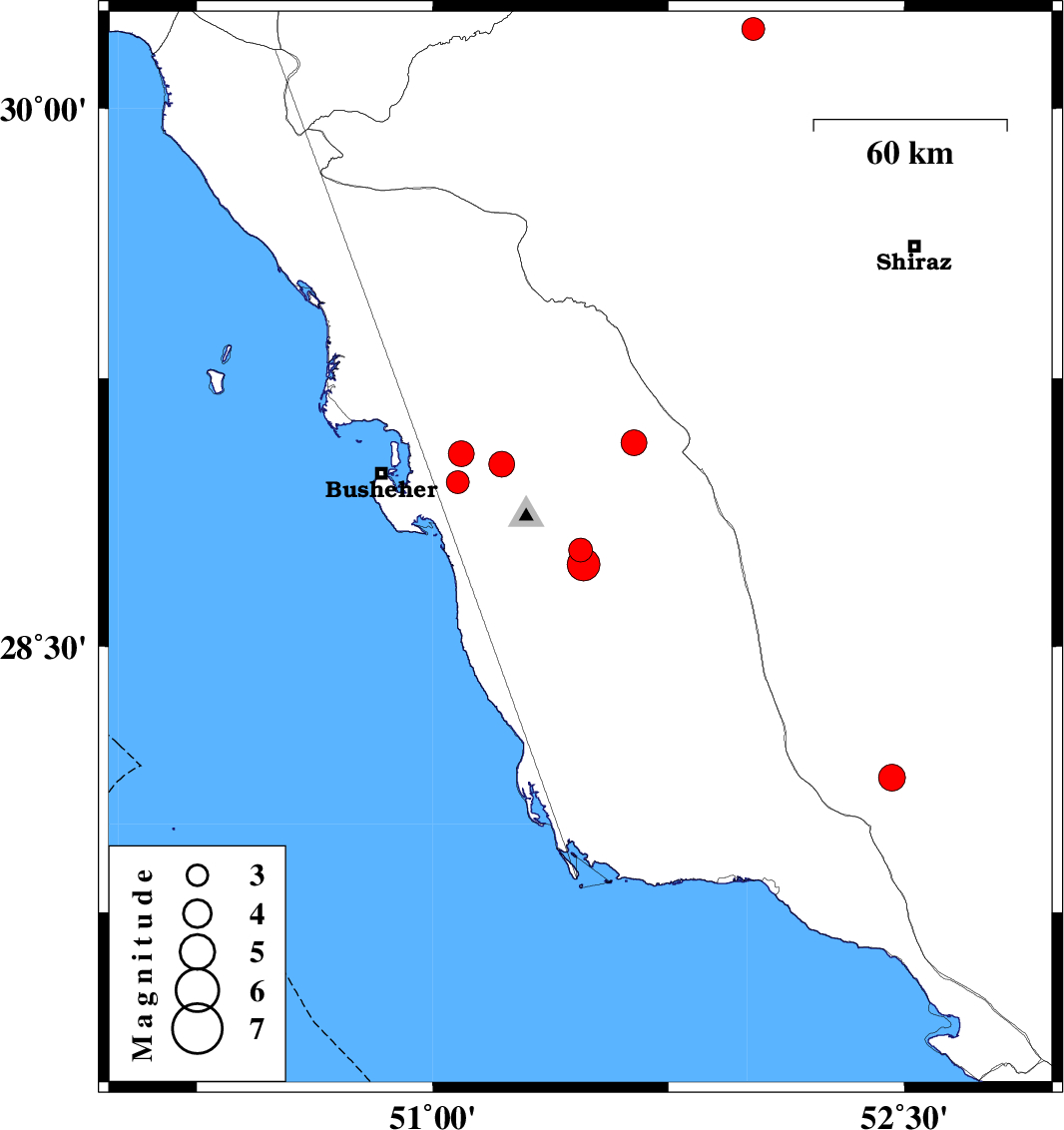
| 2012/02/16 | 21:00:41.6 | 00:30:41.6 | 28.77 | 51.47 | 16 | ML:3.4 | Bushehr Province, 16 km North of Khormog | ||
| 2012/02/05 | 06:10:40.9 | 09:40:40.9 | 28.73 | 51.48 | 14 | ML:4.7 | Bushehr Province, 14 km East of Khormog | ||
| 2012/01/27 | 00:52:45.8 | 04:22:45.8 | 29.01 | 51.22 | 16 | ML:3.7 | Bushehr Province, 16 km North of Ahram | ||
| 2012/01/25 | 20:08:08.3 | 23:38:08.3 | 28.13 | 52.46 | 14 | ML:3.8 | Fars Province, 36 km North-East of Jam | ||
| 2012/01/25 | 17:59:45.0 | 21:29:45.0 | 28.13 | 52.46 | 14 | ML:3.3 | Fars Province, 36 km North-East of Jam | ||
| 2012/01/25 | 16:18:25.8 | 19:48:25.8 | 29.04 | 51.09 | 12 | ML:3.7 | Bushehr Province, 26 km East of Busheher | ||
| 2012/01/25 | 11:14:06.2 | 14:44:06.2 | 28.96 | 51.08 | 17 | ML:3.3 | Bushehr Province, 20 km West of Ahram | ||
| 2012/01/22 | 03:22:20.2 | 06:52:20.2 | 29.07 | 51.64 | 29 | ML:3.7 | Bushehr Province, 61 km South of Kazerun | ||
| 2012/01/21 | 18:43:09.3 | 22:13:09.3 | 30.22 | 52.02 | 14 | ML:3.3 | Fars Province, 6 km Ardakan |