
| Prel. Rep. | Date | Time(UTC) | Time(Local) | Lat. | Lon. | Depth | Mag. | Region | Waveform |
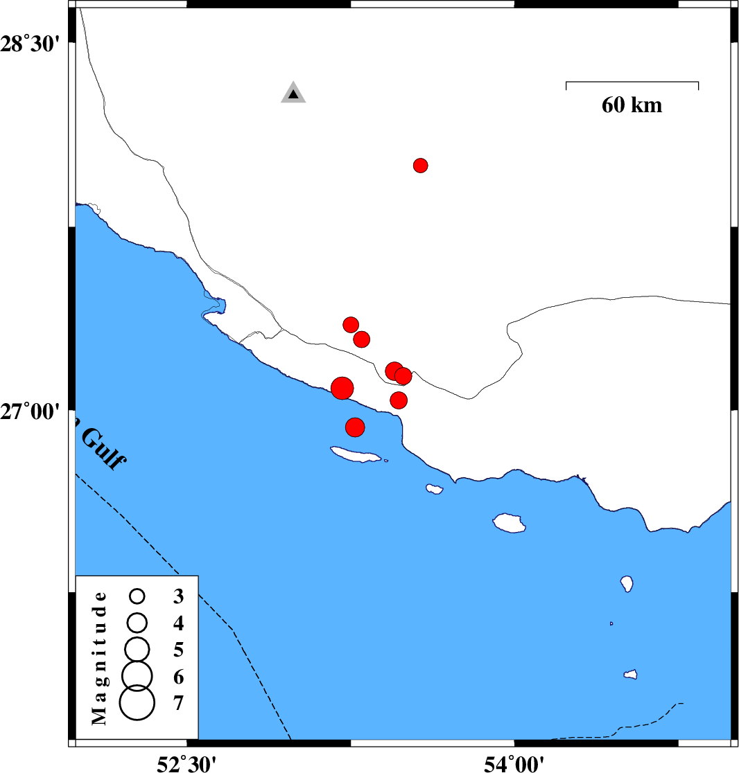
| 2011/12/13 | 14:42:51.7 | 18:12:51.7 | 27.14 | 53.49 | 42 | ML:3.5 | Fars Province, 39 km South-East of Lamerd | ||
| 2011/12/11 | 21:50:54.6 | 01:20:54.6 | 28 | 53.57 | 18 | ML:2.9 | Fars Province, 55 km South of Jahrom | ||
| 2011/12/09 | 13:09:52.6 | 16:39:52.6 | 27.04 | 53.47 | 18 | ML:3.5 | Hormozgan Province, 44 km South-East of Lamerd | ||
| 2011/12/09 | 08:46:32.1 | 12:16:32.1 | 26.93 | 53.27 | 16 | ML:3.9 | Persian Gulf, 46 km South-East of Lamerd | ||
| 2011/12/09 | 06:42:12.5 | 10:12:12.5 | 27.29 | 53.3 | 14 | ML:3.4 | Fars Province, 13 km East of Lamerd | ||
| 2011/12/09 | 03:34:12.5 | 07:04:12.5 | 27.35 | 53.25 | 6 | ML:3.2 | Fars Province, 9 km Lamerd | ||
| 2011/12/09 | 03:23:30.9 | 06:53:30.9 | 27.09 | 53.21 | 18 | ML:4.7 | Hormozgan Province, 27 km South of Lamerd | ||
| 2011/12/09 | 02:43:35.3 | 06:13:35.3 | 27.16 | 53.45 | 46 | ML:3.8 | Fars Province, 33 km South-East of Lamerd |