
Magnitude |
:3.8 |
| Date & Time (UTC) | 2011-12-09 02:43:35.3 |
| Date & Time (Local) | 1390/9/18 06:13:35.3 |
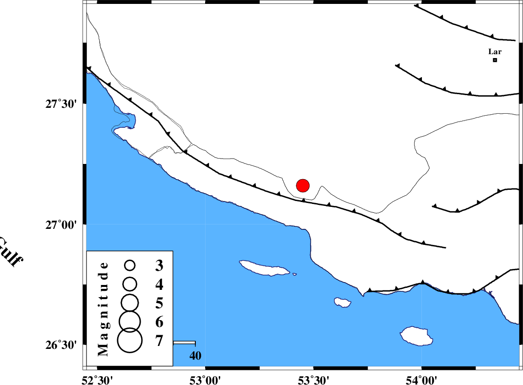
| Location | Lat:27.16 Lon: 53.45 |
| Region | Fars Province, 33 km South-East of Lamerd |
Nearest Cities |
|
| 17 km West of Ashkenan, Fars Province | |
| 28 km West of Ahl, Fars Province | |
| 30 km South of Beyram, Fars Province | |
| 34 km South East of Lamerd, Fars Province | |
| 48 km South of Fedagh, Fars Province | |
| Depth | 46 km |
| Agency | |
Faults within 150 km: |
|
| MFF3 (Length: 292 km) , Distance to epicenter: 7 km | |
| ZFF1 (Length: 165 km) , Distance to epicenter: 57 km | |
| MFF1 (Length: 180 km) , Distance to epicenter: 60 km | |
| Number of Phases | 5 |
| RMS | 0.3 |
| Number of Stations | 5 |
| Error in Latitude | >8 km |
| Error in Longitude | 2.9 km |
| Error in Depth | 8.7 km |
Download waveform in seisan format
to download seisan software Click here
to access information about IIEES stations Click here
Amplitude | ||||||||
| UID | Agency | Station | Component | Amplitude | Period | Arrival Time | Proccessing Time | Signal Clip |
| 80930 | IIEES | GHIR | E | 2292.8 | 0.4 | 2011-12-09 02:44:18 | 2011-12-09 02:16:00 | n |
| 80931 | IIEES | GHIR | N | 1342.7 | 0.4 | 2011-12-09 02:44:23 | 2011-12-09 02:16:00 | n |
| 80932 | IIEES | AHRM | N | 439.1 | 0.52 | 2011-12-09 02:45:07 | 2011-12-09 02:16:00 | n |
Phase | ||||||||||||
| Agency | Station | Component | Phase Type | Phase Quality | First Motion | Observed Arrival Time | Time Residual | Loc. Flag | Input Weight | Distance | Azimuth | |
| IIEES | GHIR | N | Pg | E | 2011-12-09 02:43:58 | 0.2 | y | 132 | 340 | |||
| IIEES | BNDS | Z | Pn | E | 2011-12-09 02:44:13 | 0.07 | y | 271 | 84 | |||
| IIEES | AHRM | N | Sg | E | 2011-12-09 02:44:53 | 0.04 | y | 283 | 312 | |||
| IIEES | KRBR | N | Sg | E | 2011-12-09 02:45:38 | 0.05 | y | 450 | 45 | |||
| IIEES | NASN | Z | Pn | E | 2011-12-09 02:44:57 | -0.66 | y | 628 | 355 | |||