| Prel. Rep. | Date | Time(UTC) | Time(Local) | Lat. | Lon. | Depth | Mag. | Region | Waveform |
|
|
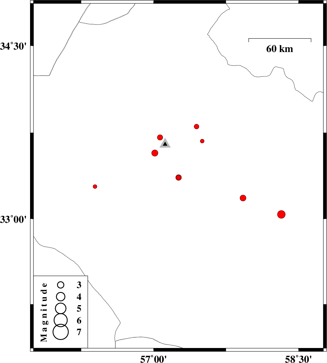
2015/09/25
|
03:32:10.1
|
07:02:10.1
| 33.362 | 57.257 | 14 |
ML:1.9
|
Yazd Province, 40 km South-East of Tabas | |
|
|
2015/09/25
|
00:46:26.9
|
04:16:26.9
| 33.36 | 57.258 | 14 |
ML:2.7
|
Yazd Province, 41 km South-East of Tabas | |
|
|
2015/09/24
|
11:41:42.8
|
15:11:42.8
| 33.677 | 57.503 | 5 |
ML:1.9
|
Khorasan(center) Province, 54 km -East of Tabas | |
|
|
2015/09/22
|
09:20:53.8
|
12:50:53.8
| 33.573 | 57.013 | 7 |
ML:3
|
Yazd Province, 9 km of Tabas | |
|
|
2015/09/18
|
19:27:04.5
|
23:57:04.5
| 33.803 | 57.444 | 15 |
ML:2.3
|
Khorasan(center) Province, 53 km North-East of Tabas | |
|
|
2015/09/15
|
00:03:59.9
|
04:33:59.9
| 32.11 | 55.896 | 15 |
ML:2.4
|
Yazd Province, 73 km North-East of Bafq | |
|
|
2015/09/13
|
01:05:43.2
|
05:35:43.2
| 33.039 | 58.322 | 14 |
ML:3.7
|
Khorasan(center) Province, 86 km North-West of Birjand | |
|
|
2015/09/11
|
08:02:39.7
|
12:32:39.7
| 33.281 | 56.393 | 14 |
ML:1.8
|
Yazd Province, 61 km South-West of Tabas | |
|
|
2015/09/10
|
23:18:38.8
|
03:48:38.8
| 33.709 | 57.066 | 14 |
ML:2.5
|
Yazd Province, 18 km North-East of Tabas | |
|
|
2015/09/05
|
23:27:47.8
|
03:57:47.8
| 33.182 | 57.925 | 14 |
ML:2.8
|
Khorasan(center) Province, 95 km South-West of Ferdows | |
