
Magnitude |
:1.9 |
| Date & Time (UTC) | 2015-09-25 03:32:10.1 |
| Date & Time (Local) | 1394/7/3 07:02:10.1 |
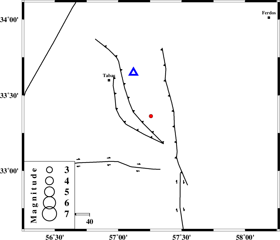
| Location | Lat:33.362 Lon: 57.257 |
| Region | Yazd Province, 40 km South-East of Tabas |
Nearest Cities |
|
| 23 km North West of Dihuk, Yazd Province | |
| 32 km East of Kerit, Yazd Province | |
| 39 km South East of Oshtoqran, Yazd Province | |
| 39 km South West of Arsak, Khorasan(center) Province | |
| 40 km South East of Tabas, Yazd Province | |
| Depth | 14 km |
| Agency | |
Faults within 150 km: |
|
| TABAS_F1 (Length: 91 km) , Distance to epicenter: 8 km | |
| TABAS_F2 (Length: 67 km) , Distance to epicenter: 14 km | |
| ESFARDIAR_F (Length: 94 km) , Distance to epicenter: 17 km | |
| Number of Phases | 5 |
| RMS | 0.4 |
| Number of Stations | 3 |
| Error in Latitude | >4.2 km |
| Error in Longitude | 3.4 km |
| Error in Depth | 8.7 km |
Download waveform in seisan format
to download seisan software Click here
to access information about IIEES stations Click here
Amplitude | ||||||||
| UID | Agency | Station | Component | Amplitude | Period | Arrival Time | Proccessing Time | Signal Clip |
| 101551 | IIEES | TABS | E | 140.1 | 0.23 | 2015-09-25 03:32:24 | 2015-10-07 11:03:00 | n |
| 101552 | IIEES | YZKH | E | 5.8 | 0.37 | 2015-09-25 03:33:29 | 2015-10-07 11:03:00 | n |
Phase | ||||||||||||
| Agency | Station | Component | Phase Type | Phase Quality | First Motion | Observed Arrival Time | Time Residual | Loc. Flag | Input Weight | Distance | Azimuth | |
| IIEES | TABS | Z | Pg | E | 2015-09-25 03:32:16 | -0.23 | y | 34.3 | 338 | |||
| IIEES | BSRN | Z | Pn | E | 2015-09-25 03:32:47 | 0.18 | y | 234 | 131 | |||
| IIEES | BSRN | N | Sg | E | 2015-09-25 03:33:16 | -0.23 | y | 234 | 131 | |||
| IIEES | YZKH | Z | Pn | E | 2015-09-25 03:32:52 | 0.66 | y | 272 | 247 | |||
| IIEES | YZKH | E | Sg | E | 2015-09-25 03:33:26 | -0.37 | y | 272 | 247 | |||