
Magnitude |
:1.9 |
| Date & Time (UTC) | 2015-09-24 11:41:42.8 |
| Date & Time (Local) | 1394/7/2 15:11:42.8 |
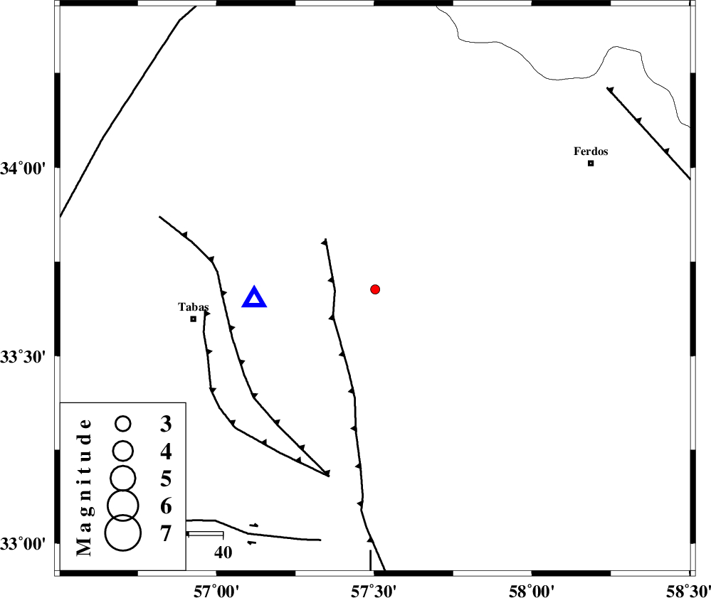
| Location | Lat:33.677 Lon: 57.503 |
| Region | Khorasan(center) Province, 54 km -East of Tabas |
Nearest Cities |
|
| 11 km East of Arsak, Khorasan(center) Province | |
| 22 km South of Boshravieh, Khorasan(center) Province | |
| 28 km South East of Reqqeh, Khorasan(center) Province | |
| 43 km North of Dihuk, Yazd Province | |
| 43 km South East of Qaniabad, Khorasan(center) Province | |
| Depth | 5 km |
| Agency | |
Faults within 150 km: |
|
| ESFARDIAR_F (Length: 94 km) , Distance to epicenter: 12 km | |
| TABAS_F1 (Length: 91 km) , Distance to epicenter: 44 km | |
| TABAS_F2 (Length: 67 km) , Distance to epicenter: 50 km | |
| Number of Phases | 6 |
| RMS | 0.3 |
| Number of Stations | 5 |
| Error in Latitude | >4.9 km |
| Error in Longitude | 4.5 km |
| Error in Depth | 6.7 km |
Download waveform in seisan format
to download seisan software Click here
to access information about IIEES stations Click here
Amplitude | ||||||||
| UID | Agency | Station | Component | Amplitude | Period | Arrival Time | Proccessing Time | Signal Clip |
| 101543 | IIEES | TABS | E | 130 | 0.16 | 2015-09-24 11:41:55 | 2015-10-07 11:03:00 | n |
| 101544 | IIEES | TABS | N | 198.8 | 0.11 | 2015-09-24 11:41:55 | 2015-10-07 11:03:00 | n |
| 101545 | IIEES | YZKH | E | 4.3 | 0.37 | 2015-09-24 11:43:13 | 2015-10-07 11:03:00 | n |
Phase | ||||||||||||
| Agency | Station | Component | Phase Type | Phase Quality | First Motion | Observed Arrival Time | Time Residual | Loc. Flag | Input Weight | Distance | Azimuth | |
| IIEES | TABS | Z | Pg | E | 2015-09-24 11:41:49 | -0.17 | y | 35.7 | 265 | |||
| IIEES | TABS | E | Sg | E | 2015-09-24 11:41:54 | 0.15 | y | 35.7 | 265 | |||
| IIEES | BSRN | Z | Pn | E | 2015-09-24 11:42:21 | -0.35 | y | 243 | 141 | |||
| IIEES | SHRT | Z | P | E | 2015-09-24 11:42:24 | 0.42 | y | 259 | 90 | |||
| IIEES | SHRO | Z | P | E | 2015-09-24 11:42:27 | -0.22 | y | 292 | 333 | |||
| IIEES | YZKH | Z | Pn | E | 2015-09-24 11:42:30 | 0.18 | y | 307 | 243 | |||