
Magnitude |
:2.8 |
| Date & Time (UTC) | 2015-09-05 23:27:47.8 |
| Date & Time (Local) | 1394/6/15 03:57:47.8 |
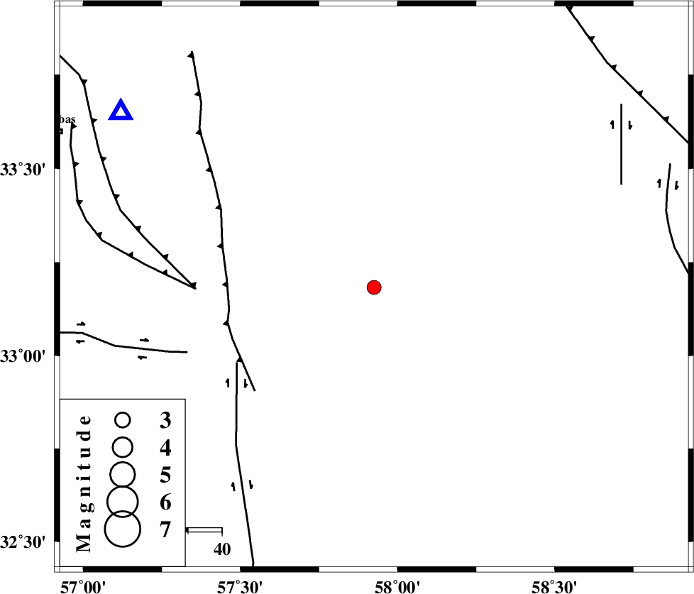
| Location | Lat:33.182 Lon: 57.925 |
| Region | Khorasan(center) Province, 95 km South-West of Ferdows |
Nearest Cities |
|
| 26 km North East of Arababad, Yazd Province | |
| 42 km South East of Dihuk, Yazd Province | |
| 54 km North West of Hur, Khorasan(south) Province | |
| 69 km South West of Seqaleh, Khorasan(center) Province | |
| 76 km South East of Arsak, Khorasan(center) Province | |
| Depth | 14 km |
| Agency | |
Faults within 150 km: |
|
| ESFARDIAR_F (Length: 94 km) , Distance to epicenter: 43 km | |
| NAYBAND_F (Length: 258 km) , Distance to epicenter: 46 km | |
| TABAS_F2 (Length: 67 km) , Distance to epicenter: 53 km | |
| Number of Phases | 6 |
| RMS | 0.3 |
| Number of Stations | 4 |
| Error in Latitude | >3.8 km |
| Error in Longitude | 2.3 km |
| Error in Depth | 6.8 km |
Download waveform in seisan format
to download seisan software Click here
to access information about IIEES stations Click here
Amplitude | ||||||||
| UID | Agency | Station | Component | Amplitude | Period | Arrival Time | Proccessing Time | Signal Clip |
| 100737 | IIEES | TABS | E | 306.6 | 0.23 | 2015-09-05 23:28:15 | 2015-09-06 07:20:00 | n |
| 100738 | IIEES | SHRT | N | 86.9 | 0.76 | 2015-09-05 23:28:56 | 2015-09-06 07:20:00 | n |
| 100739 | IIEES | YZKH | E | 22.9 | 0.46 | 2015-09-05 23:29:25 | 2015-09-06 07:20:00 | n |
Phase | ||||||||||||
| Agency | Station | Component | Phase Type | Phase Quality | First Motion | Observed Arrival Time | Time Residual | Loc. Flag | Input Weight | Distance | Azimuth | |
| IIEES | TABS | Z | Pg | E | 2015-09-05 23:28:03 | -0.27 | y | 91.1 | 305 | |||
| IIEES | TABS | N | Sg | E | 2015-09-05 23:28:14 | -0.05 | y | 91.1 | 305 | |||
| IIEES | BSRN | Z | Pg | E | 2015-09-05 23:28:16 | -0.32 | y | 176 | 140 | |||
| IIEES | SHRT | Z | Pn | E | 2015-09-05 23:28:23 | 0.02 | y | 226 | 76 | |||
| IIEES | SHRT | N | Sg | E | 2015-09-05 23:28:51 | 0.15 | y | 226 | 76 | |||
| IIEES | YZKH | Z | Pn | E | 2015-09-05 23:28:36 | 0.52 | y | 324 | 255 | |||