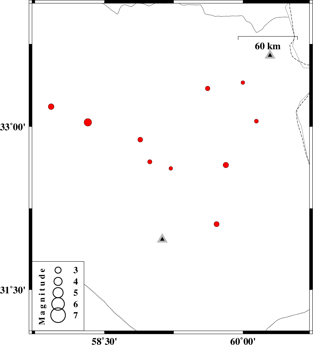
| Prel. Rep. | Date | Time(UTC) | Time(Local) | Lat. | Lon. | Depth | Mag. | Region | Waveform |
|
|
2015/09/26
|
17:46:52.0
|
21:16:52.0
| 32.618 | 59.218 | 17 |
ML:1.9
|
Khorasan(south) Province, 31 km South of Birjand | |
|
|
2015/09/17
|
06:13:12.4
|
10:43:12.4
| 32.678 | 58.991 | 15 |
ML:2.1
|
Khorasan(south) Province, 33 km South-West of Birjand | |
|
|
2015/09/13
|
01:05:43.2
|
05:35:43.2
| 33.039 | 58.322 | 14 |
ML:3.7
|
Khorasan(center) Province, 86 km North-West of Birjand | |
|
|
2015/09/11
|
11:28:23.7
|
15:58:23.7
| 33.347 | 59.616 | 15 |
ML:2.2
|
Khorasan(south) Province, 58 km South-East of Qaen | |
|
|
2015/09/11
|
08:18:47.4
|
12:48:47.4
| 33.4 | 59.997 | 17 |
ML:1.9
|
Khorasan(south) Province, 89 km North-East of Sarbisheh | |
|
|
2015/09/08
|
01:35:24.1
|
06:05:24.1
| 33.049 | 60.144 | 18 |
ML:2
|
Khorasan(south) Province, 58 km North-East of Sarbisheh | |
|
|
2015/09/05
|
23:27:47.8
|
03:57:47.8
| 33.182 | 57.925 | 14 |
ML:2.8
|
Khorasan(center) Province, 95 km South-West of Ferdows | |
|
|
2015/09/05
|
00:35:17.2
|
05:05:17.2
| 32.88 | 58.888 | 16 |
ML:2.4
|
Khorasan(south) Province, 32 km -West of Birjand | |
|
|
2015/08/28
|
14:55:22.4
|
19:25:22.4
| 32.649 | 59.813 | 6 |
ML:2.7
|
Khorasan(south) Province, 4 km of Sarbisheh | |
|
|
2015/08/28
|
02:30:17.0
|
07:00:17.0
| 32.106 | 59.714 | 14 |
ML:2.6
|
Khorasan(south) Province, 58 km South of Sarbisheh | |
