| Prel. Rep. | Date | Time(UTC) | Time(Local) | Lat. | Lon. | Depth | Mag. | Region | Waveform |
|
|
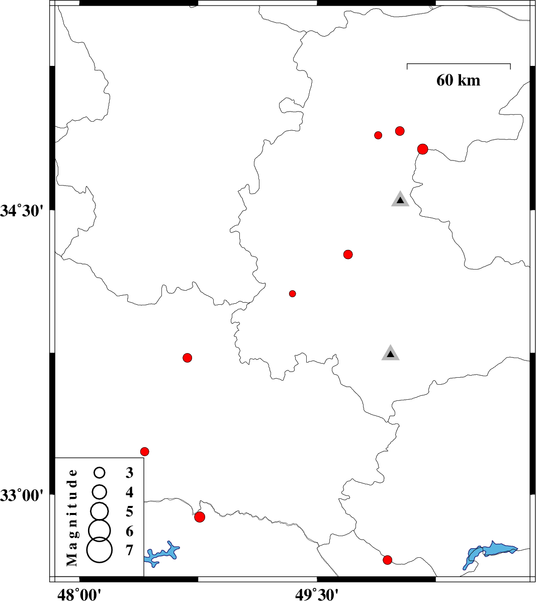
2015/08/31
|
13:14:48.6
|
17:44:48.6
| 34.062 | 49.345 | 15 |
ML:1.9
|
Markazi Province, 16 km North of Shazand | |
|
|
2015/08/29
|
04:25:26.0
|
08:55:26.0
| 33.227 | 48.411 | 14 |
ML:2.4
|
Lorestan Province, 29 km South of Khorramabad | |
|
|
2015/08/27
|
04:59:22.3
|
09:29:22.3
| 34.912 | 50.023 | 15 |
ML:2.5
|
Markazi Province, 24 km North of Tafresh | |
|
|
2015/08/26
|
13:38:43.0
|
18:08:43.0
| 32.88 | 48.76 | 15 |
ML:2.9
|
Khoozestan Province, 60 km North-East of Andimeshk | |
|
|
2015/08/25
|
23:13:11.9
|
03:43:11.9
| 34.89 | 49.887 | 15 |
ML:2.1
|
Markazi Province, 25 km North-West of Tafresh | |
|
|
2015/08/25
|
17:44:14.0
|
22:14:14.0
| 32.745 | 48.095 | 15 |
ML:3.5
|
Khoozestan Province, 40 km North-West of Andimeshk | |
|
|
2015/08/25
|
16:16:01.3
|
20:46:01.3
| 32.815 | 48.213 | 37 |
ML:2.8
|
Khoozestan Province, 42 km North-West of Andimeshk | |
|
|
2015/08/21
|
04:16:15.5
|
08:46:15.5
| 34.267 | 49.696 | 14 |
ML:2.5
|
Markazi Province, 20 km North of Arak | |
|
|
2015/08/18
|
03:38:11.1
|
08:08:11.1
| 32.651 | 49.946 | 14 |
ML:2.5
|
Chaharmahal Bakhtiari Province, 26 km North-West of Chelgard | |
|
|
2015/08/14
|
20:26:46.1
|
00:56:46.1
| 33.724 | 48.681 | 15 |
ML:2.5
|
Lorestan Province, 20 km South of Borujerd | |
|
|
2015/08/02
|
21:19:22.7
|
01:49:22.7
| 34.818 | 50.167 | 16 |
ML:2.9
|
Qom Province, 19 km North-East of Tafresh | |
