
Magnitude |
:1.9 |
| Date & Time (UTC) | 2015-08-31 13:14:48.6 |
| Date & Time (Local) | 1394/6/9 17:44:48.6 |
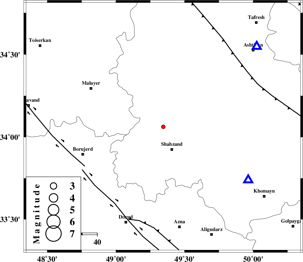
| Location | Lat:34.062 Lon: 49.345 |
| Region | Markazi Province, 16 km North of Shazand |
Nearest Cities |
|
| 6 km North of Tureh, Markazi Province | |
| 14 km North East of Nahrmian, Markazi Province | |
| 16 km North of Shazand, Markazi Province | |
| 20 km North of Astaneh, Markazi Province | |
| 21 km North West of Sanjan, Markazi Province | |
| Depth | 15 km |
| Agency | |
Faults within 150 km: |
|
| NAHAVAND_F (Length: 102 km) , Distance to epicenter: 59 km | |
| DORUD (Length: 100 km) , Distance to epicenter: 60 km | |
| MAIN_ZAGROS_R_F (Length: 1106 km) , Distance to epicenter: 65 km | |
| Number of Phases | 5 |
| RMS | 0 |
| Number of Stations | 4 |
| Error in Latitude | >3.7 km |
| Error in Longitude | 3.1 km |
| Error in Depth | 5.1 km |
Download waveform in seisan format
to download seisan software Click here
to access information about IIEES stations Click here
Amplitude | ||||||||
| UID | Agency | Station | Component | Amplitude | Period | Arrival Time | Proccessing Time | Signal Clip |
| 100642 | IIEES | GHVR | E | 14.1 | 0.52 | 2015-08-31 13:15:45 | 2015-09-01 06:56:00 | n |
| 100643 | IIEES | GHVR | N | 13.3 | 0.69 | 2015-08-31 13:15:46 | 2015-09-01 06:56:00 | n |
| 100644 | IIEES | SNGE | N | 11 | 0.59 | 2015-08-31 13:16:01 | 2015-09-01 06:56:00 | n |
Phase | ||||||||||||
| Agency | Station | Component | Phase Type | Phase Quality | First Motion | Observed Arrival Time | Time Residual | Loc. Flag | Input Weight | Distance | Azimuth | |
| IIEES | ASAO | Z | Pg | E | 2015-08-31 13:15:03 | 0.07 | y | 82.6 | 49 | |||
| IIEES | ASAO | N | Sg | E | 2015-08-31 13:15:13 | -0.04 | y | 82.6 | 49 | |||
| IIEES | GHVR | Z | Pg | E | 2015-08-31 13:15:18 | -0.04 | y | 181 | 75 | |||
| IIEES | SNGE | Z | Pn | E | 2015-08-31 13:15:23 | -0.03 | y | 216 | 302 | |||
| IIEES | CHTH | Z | Pn | E | 2015-08-31 13:15:28 | 0.03 | y | 261 | 38 | |||