
Magnitude |
:2.5 |
| Date & Time (UTC) | 2015-08-14 20:26:46.1 |
| Date & Time (Local) | 1394/5/24 00:56:46.1 |
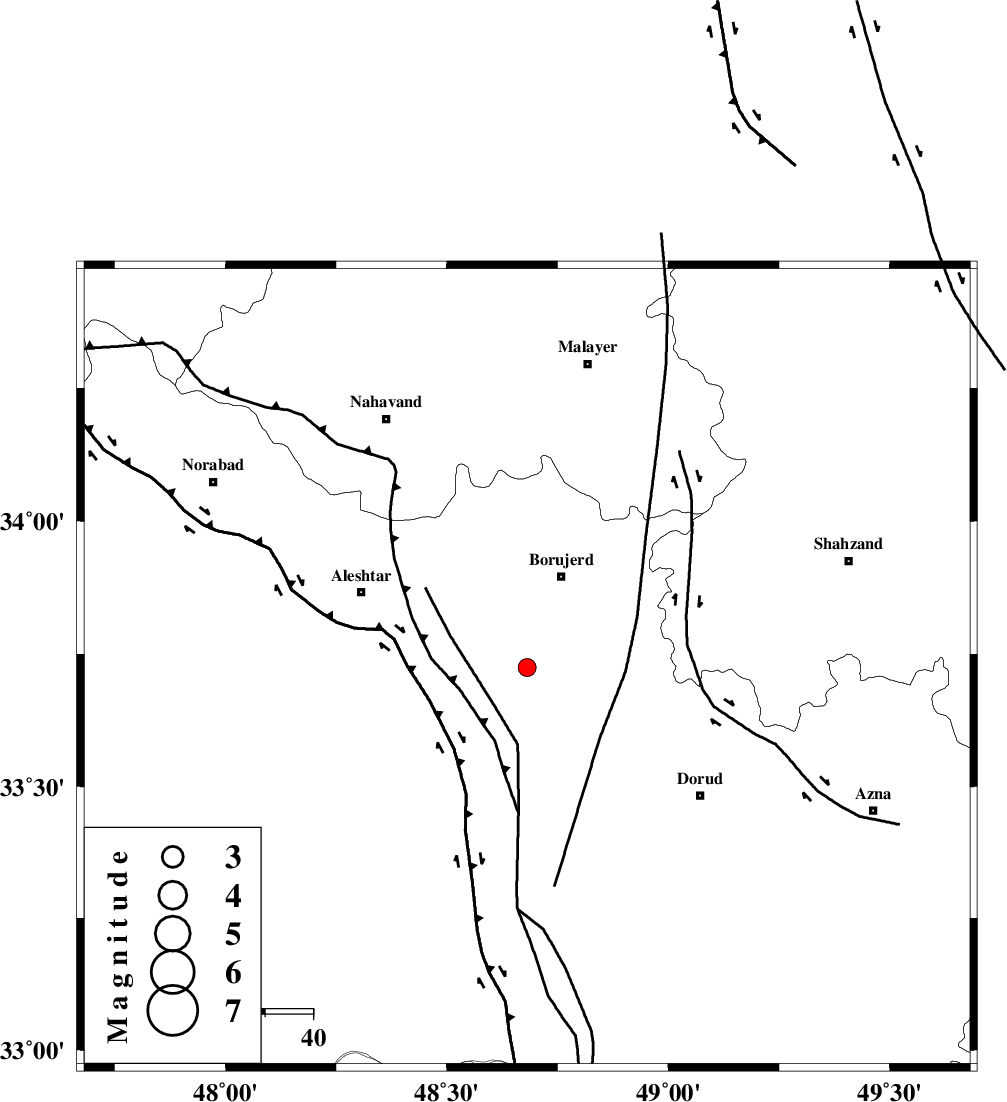
| Location | Lat:33.724 Lon: 48.681 |
| Region | Lorestan Province, 20 km South of Borujerd |
Nearest Cities |
|
| 6 km of Pellekan-e sofla, Lorestan Province | |
| 14 km North East of Chogolvandi, Lorestan Province | |
| 14 km North East of Cheharborji, Lorestan Province | |
| 16 km South West of Hemmatabad, Lorestan Province | |
| 20 km North West of Chalanchulan, Lorestan Province | |
| Depth | 15 km |
| Agency | |
Faults within 150 km: |
|
| DORUD (Length: 100 km) , Distance to epicenter: 11 km | |
| NAHAVAND_F (Length: 102 km) , Distance to epicenter: 14 km | |
| HZF4 (Length: 492 km) , Distance to epicenter: 44 km | |
| Number of Phases | 6 |
| RMS | 0.1 |
| Number of Stations | 5 |
| Error in Latitude | >4.9 km |
| Error in Longitude | 2 km |
| Error in Depth | 4.6 km |
Download waveform in seisan format
to download seisan software Click here
to access information about IIEES stations Click here
Amplitude | ||||||||
| UID | Agency | Station | Component | Amplitude | Period | Arrival Time | Proccessing Time | Signal Clip |
| 100352 | IIEES | GHVR | N | 28.9 | 0.39 | 2015-08-14 20:28:00 | 2015-08-15 06:34:00 | n |
Phase | ||||||||||||
| Agency | Station | Component | Phase Type | Phase Quality | First Motion | Observed Arrival Time | Time Residual | Loc. Flag | Input Weight | Distance | Azimuth | |
| IIEES | SNGE | Z | Pg | E | 2015-08-14 20:27:18 | -0.01 | y | 195 | 321 | |||
| IIEES | GHVR | Z | Pn | E | 2015-08-14 20:27:24 | -0.17 | y | 251 | 70 | |||
| IIEES | GHVR | E | Sg | E | 2015-08-14 20:27:57 | 0.01 | y | 251 | 70 | |||
| IIEES | CHTH | Z | Pn | E | 2015-08-14 20:27:35 | 0.18 | y | 330 | 42 | |||
| IIEES | DAMV | Z | Pn | E | 2015-08-14 20:27:39 | -0.08 | y | 368 | 54 | |||
| IIEES | NASN | Z | Pn | E | 2015-08-14 20:27:43 | 0.1 | y | 398 | 104 | |||