| Prel. Rep. | Date | Time(UTC) | Time(Local) | Lat. | Lon. | Depth | Mag. | Region | Waveform |
|
|
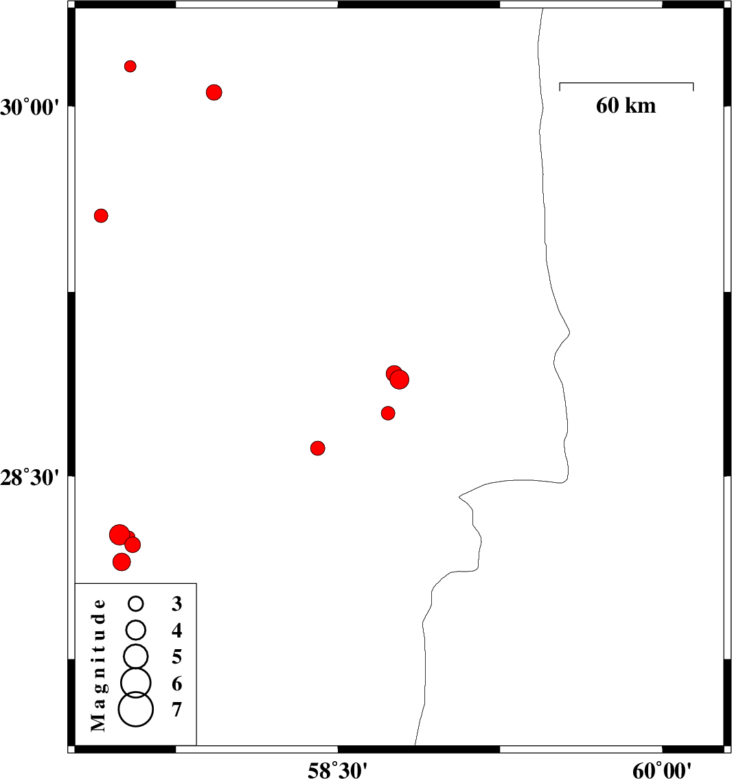
2015/07/24
|
15:04:18.3
|
19:34:18.3
| 28.894 | 58.784 | 14 |
ML:3.9
|
Kerman Province, 48 km South-East of Bam | |
|
|
2015/07/24
|
02:51:57.0
|
07:21:57.0
| 28.757 | 58.732 | 14 |
ML:2.8
|
Kerman Province, 54 km South-East of Bam | |
|
|
2015/07/22
|
07:49:33.4
|
12:19:33.4
| 28.917 | 58.76 | 14 |
ML:3.4
|
Kerman Province, 45 km South-East of Bam | |
|
|
2015/07/20
|
14:54:15.1
|
19:24:15.1
| 28.614 | 58.406 | 18 |
ML:2.9
|
Kerman Province, 55 km South of Bam | |
|
|
2015/07/20
|
01:22:32.6
|
05:52:32.6
| 30.055 | 57.927 | 14 |
ML:3.3
|
Kerman Province, 86 km South-East of Kerman | |
|
|
2015/07/17
|
19:55:01.3
|
00:25:01.3
| 29.558 | 57.404 | 18 |
ML:2.8
|
Kerman Province, 87 km South-East of Kerman | |
|
|
2015/07/01
|
07:04:51.9
|
11:34:51.9
| 28.22 | 57.55 | 16 |
ML:3.2
|
Kerman Province, 33 km North-West of Kahnuj | |
|
|
2015/07/01
|
06:45:56.4
|
11:15:56.4
| 28.15 | 57.5 | 46 |
ML:3.7
|
Kerman Province, 29 km North-West of Kahnuj | |
|
|
2015/07/01
|
06:43:26.1
|
11:13:26.1
| 28.26 | 57.49 | 18 |
ML:4.2
|
Kerman Province, 40 km North-West of Kahnuj | |
|
|
2015/07/01
|
00:00:25.2
|
04:30:25.2
| 28.251 | 57.534 | 14 |
ML:2.6
|
Kerman Province, 37 km North-West of Kahnuj | |
|
|
2015/07/01
|
00:00:25.2
|
04:30:25.2
| 28.25 | 57.53 | 14 |
ML:2.6
|
Kerman Province, 37 km North-West of Kahnuj | |
|
|
2015/06/24
|
19:36:54.9
|
00:06:54.9
| 30.16 | 57.54 | 18 |
ML:2.4
|
Kerman Province, 47 km South-East of Kerman | |
