
Magnitude |
:3.7 |
| Date & Time (UTC) | 2015-07-01 06:45:56.4 |
| Date & Time (Local) | 1394/4/10 11:15:56.4 |
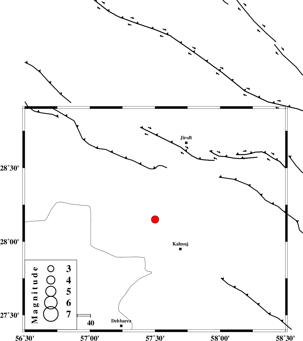
| Location | Lat:28.15 Lon: 57.5 |
| Region | Kerman Province, 29 km North-West of Kahnuj |
Nearest Cities |
|
| 9 km of Bolock, Kerman Province | |
| 11 km North of Mehrueye-e paeen, Kerman Province | |
| 19 km East of Hurpasefid, Kerman Province | |
| 24 km North East of Faryab, Kerman Province | |
| 29 km North West of Kahnuj, Kerman Province | |
| Depth | 46 km |
| Agency | |
Faults within 150 km: |
|
| SABZEVARAN_F (Length: 190 km) , Distance to epicenter: 23 km | |
| JIROFT_F (Length: 144 km) , Distance to epicenter: 29 km | |
| MAIN_ZAGROS_R_F (Length: 1106 km) , Distance to epicenter: 65 km | |
| Number of Phases | 5 |
| RMS | 0.3 |
| Number of Stations | 3 |
| Error in Latitude | >2.9 km |
| Error in Longitude | 7.6 km |
| Error in Depth | 9.8 km |
Download waveform in seisan format
to download seisan software Click here
to access information about IIEES stations Click here
Amplitude | ||||||||
| UID | Agency | Station | Component | Amplitude | Period | Arrival Time | Proccessing Time | Signal Clip |
| 96095 | IIEES | KRBR | E | 517.7 | 0.49 | 2015-07-01 06:47:03 | 2015-07-01 09:09:00 | n |
| 96096 | IIEES | KRBR | N | 631.7 | 0.49 | 2015-07-01 06:47:05 | 2015-07-01 09:09:00 | n |
Phase | ||||||||||||
| Agency | Station | Component | Phase Type | Phase Quality | First Motion | Observed Arrival Time | Time Residual | Loc. Flag | Input Weight | Distance | Azimuth | |
| IIEES | BNDS | Z | Pg | E | 2015-07-01 06:46:21 | -0.47 | y | 155 | 238 | |||
| IIEES | BNDS | N | Sg | E | 2015-07-01 06:46:41 | 0.36 | y | 155 | 238 | |||
| IIEES | KRBR | Z | Pn | E | 2015-07-01 06:46:28 | -0.18 | y | 215 | 341 | |||
| IIEES | KRBR | N | Sg | E | 2015-07-01 06:46:57 | 0.09 | y | 215 | 341 | |||
| IIEES | ZHSF | Z | Pn | E | 2015-07-01 06:46:46 | 0.23 | y | 358 | 62 | |||