
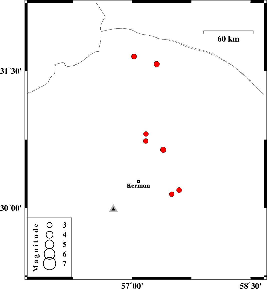
| Prel. Rep. | Date | Time(UTC) | Time(Local) | Lat. | Lon. | Depth | Mag. | Region | Waveform |
| 2025/05/11 | 19:38:27.8 | 23:08:27.8 | 30.15 | 57.501 | 12 | ML:2.8 | Kerman Province, 43 km South-East of Kerman | ||
| 2025/05/11 | 08:47:17.8 | 12:17:17.8 | 30.735 | 57.17 | 12 | ML:2.8 | Kerman Province, 50 km North of Kerman | ||
| 2025/05/03 | 01:18:46.1 | 04:48:46.1 | 31.655 | 57.023 | 12 | ML:2.9 | Kerman Province, 48 km North-East of Ravar | ||
| 2025/04/30 | 00:11:54.9 | 03:41:54.9 | 30.811 | 57.174 | 12 | ML:2.8 | Kerman Province, 58 km -East of Zarand | ||
| 2025/04/17 | 20:00:41.4 | 23:30:41.4 | 30.639 | 57.392 | 16 | ML:3.3 | Kerman Province, 49 km North-East of Kerman | ||
| 2025/04/15 | 10:28:06.7 | 13:58:06.7 | 30.195 | 57.594 | 12 | ML:2.9 | Kerman Province, 51 km -East of Kerman | ||
| 2025/04/14 | 15:05:55.1 | 18:35:55.1 | 31.572 | 57.31 | 12 | ML:3.3 | Kerman Province, 58 km North-East of Ravar |