
Magnitude |
:3.3 |
| Date & Time (UTC) | 2025-04-14 15:05:55.1 |
| Date & Time (Local) | 1404/1/25 18:35:55.1 |
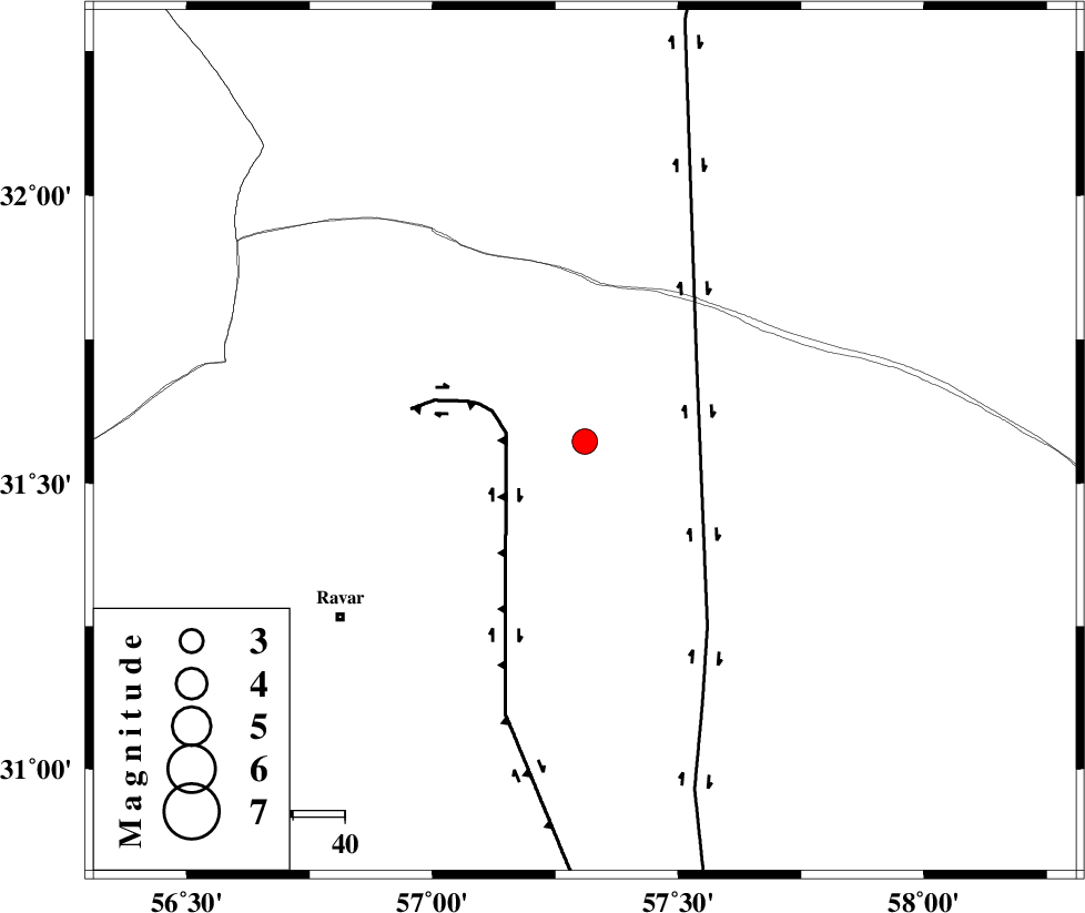
| Location | Lat:31.572 Lon: 57.31 |
| Region | Kerman Province, 58 km North-East of Ravar |
Nearest Cities |
|
| 56 km North East of Dehali, Kerman Province | |
| 58 km North East of Ravar, Kerman Province | |
| 66 km South West of Hoz-e qorban, Yazd Province | |
| 90 km North East of Ahmadi, Kerman Province | |
| 91 km North East of Dasht-e khak, Kerman Province | |
| Depth | 12 km |
| Agency | |
Faults within 150 km: |
|
| LAKARKUH_F (Length: 138 km) , Distance to epicenter: 15 km | |
| NAYBAND_F (Length: 258 km) , Distance to epicenter: 27 km | |
| KUHBANAN_F (Length: 189 km) , Distance to epicenter: 100 km | |
| Number of Phases | 9 |
| RMS | 0.3 |
| Number of Stations | 9 |
| Error in Latitude | >3.7 km |
| Error in Longitude | 3.7 km |
| Error in Depth | 20.8 km |
Download waveform in seisan format
to download seisan software Click here
to access information about IIEES stations Click here
Amplitude | ||||||||
| UID | Agency | Station | Component | Amplitude | Period | Arrival Time | Proccessing Time | Signal Clip |
| 197877 | IIEES SC | YZKH | Z | 0.3 | 1 | 2025-04-14 15:06:36 | 2025-04-15 06:56:00 | n |
| 197878 | IIEES SC | ZHSF | Z | 0.05 | 1 | 2025-04-14 15:06:52 | 2025-04-15 06:56:00 | n |
| 197879 | IIEES SC | SHRO | Z | 0.05 | 1 | 2025-04-14 15:07:06 | 2025-04-15 06:56:00 | n |
Phase | ||||||||||||
| Agency | Station | Component | Phase Type | Phase Quality | First Motion | Observed Arrival Time | Time Residual | Loc. Flag | Input Weight | Distance | Azimuth | |
| IIEES SC | BSRN | Z | EPg | E | 2025-04-14 15:06:10 | -14 | n | 4 | 178 | 76 | ||
| IIEES SC | KRBR | Z | EPg | E | 2025-04-14 15:06:25 | 0 | y | 0 | 184 | 197 | ||
| IIEES SC | TABS | Z | EPn | E | 2025-04-14 15:06:31 | -0.4 | y | 0 | 231 | 356 | ||
| IIEES SC | YZKH | Z | EPn | E | 2025-04-14 15:06:36 | -0.2 | y | 0 | 272 | 289 | ||
| IIEES SC | ZHSF | Z | EPn | E | 2025-04-14 15:06:52 | 0.1 | y | 0 | 396 | 123 | ||
| IIEES SC | NASN | Z | EPn | E | 2025-04-14 15:07:02 | 4.2 | n | 4 | 446 | 288 | ||
| IIEES SC | SHRO | Z | EPn | E | 2025-04-14 15:07:06 | 0.3 | y | 0 | 507 | 346 | ||
| IIEES SC | ABGH | Z | EPn | E | 2025-04-14 15:07:20 | 1.1 | y | 0 | 618 | 338 | ||
| IIEES SC | KAGH | Z | EPn | E | 2025-04-14 15:07:22 | -0.6 | y | 0 | 643 | 22 | ||