
Magnitude |
:2.8 |
| Date & Time (UTC) | 2025-04-30 00:11:54.9 |
| Date & Time (Local) | 1404/2/10 03:41:54.9 |
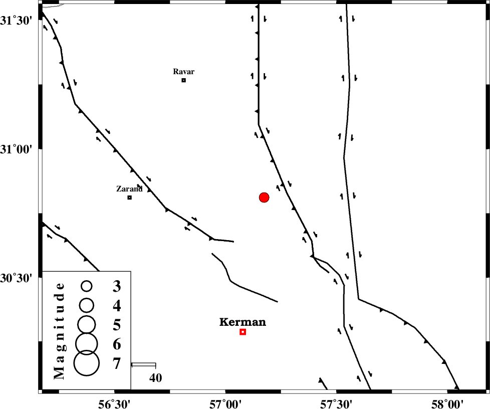
| Location | Lat:30.811 Lon: 57.174 |
| Region | Kerman Province, 58 km -East of Zarand |
Nearest Cities |
|
| 18 km North of Harjand, Kerman Province | |
| 20 km North East of Hejdak, Kerman Province | |
| 34 km North East of Chatrud, Kerman Province | |
| 35 km North East of Hutak, Kerman Province | |
| 35 km North of Dehlulu, Kerman Province | |
| Depth | 12 km |
| Agency | |
Faults within 150 km: |
|
| LAKARKUH_F (Length: 138 km) , Distance to epicenter: 10 km | |
| KUHBANAN_F (Length: 189 km) , Distance to epicenter: 23 km | |
| CHATRUD_F (Length: 37 km) , Distance to epicenter: 33 km | |
| Number of Phases | 8 |
| RMS | 0.2 |
| Number of Stations | 8 |
| Error in Latitude | >0.8 km |
| Error in Longitude | 0.8 km |
| Error in Depth | 3.9 km |
Download waveform in seisan format
to download seisan software Click here
to access information about IIEES stations Click here
Amplitude | ||||||||
| UID | Agency | Station | Component | Amplitude | Period | Arrival Time | Proccessing Time | Signal Clip |
| 198031 | IIEES SC | KRBR | Z | 0.5 | 1 | 2025-04-30 00:12:12 | 2025-04-30 04:39:00 | n |
| 198032 | IIEES SC | SHRT | Z | 0.02 | 1 | 2025-04-30 00:12:56 | 2025-04-30 04:39:00 | n |
| 198033 | IIEES SC | NASN | Z | 0.01 | 1 | 2025-04-30 00:13:01 | 2025-04-30 04:39:00 | n |
Phase | ||||||||||||
| Agency | Station | Component | Phase Type | Phase Quality | First Motion | Observed Arrival Time | Time Residual | Loc. Flag | Input Weight | Distance | Azimuth | |
| IIEES SC | KRBR | Z | EPg | E | 2025-04-30 00:12:12 | -0.1 | y | 0 | 100 | 203 | ||
| IIEES SC | BSRN | Z | EPn | E | 2025-04-30 00:12:16 | -14.8 | n | 4 | 226 | 55 | ||
| IIEES SC | YZKH | Z | EPn | E | 2025-04-30 00:12:40 | 0.1 | y | 0 | 301 | 306 | ||
| IIEES SC | TABS | Z | EPn | E | 2025-04-30 00:12:41 | 0 | y | 0 | 315 | 359 | ||
| IIEES SC | SHRT | Z | EPn | E | 2025-04-30 00:12:56 | 0 | y | 0 | 430 | 43 | ||
| IIEES SC | NASN | Z | EPn | E | 2025-04-30 00:13:01 | 0 | y | 0 | 468 | 298 | ||
| IIEES SC | GHIR | Z | EPn | E | 2025-04-30 00:13:04 | 0.6 | y | 0 | 493 | 235 | ||
| IIEES SC | SHRO | Z | EPn | E | 2025-04-30 00:13:34 | 18.7 | n | 4 | 586 | 349 | ||