
Magnitude |
:2.8 |
| Date & Time (UTC) | 2025-05-11 08:47:17.8 |
| Date & Time (Local) | 1404/2/21 12:17:17.8 |
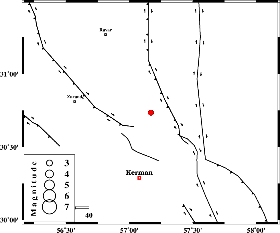
| Location | Lat:30.735 Lon: 57.17 |
| Region | Kerman Province, 50 km North of Kerman |
Nearest Cities |
|
| 9 km North of Harjand, Kerman Province | |
| 19 km East of Hejdak, Kerman Province | |
| 28 km North West of Dehlulu, Kerman Province | |
| 29 km North East of Hutak, Kerman Province | |
| 29 km North East of Chatrud, Kerman Province | |
| Depth | 12 km |
| Agency | |
Faults within 150 km: |
|
| LAKARKUH_F (Length: 138 km) , Distance to epicenter: 15 km | |
| KUHBANAN_F (Length: 189 km) , Distance to epicenter: 17 km | |
| CHATRUD_F (Length: 37 km) , Distance to epicenter: 26 km | |
| Number of Phases | 5 |
| RMS | 0.5 |
| Number of Stations | 5 |
| Error in Latitude | >30.7 km |
| Error in Longitude | 57.2 km |
| Error in Depth | 12 km |
Download waveform in seisan format
to download seisan software Click here
to access information about IIEES stations Click here
Amplitude | ||||||||
| UID | Agency | Station | Component | Amplitude | Period | Arrival Time | Proccessing Time | Signal Clip |
| 198175 | IIEES SC | KRBR | Z | 0.3 | 1 | 2025-05-11 08:47:34 | 2025-05-12 04:26:00 | n |
| 198176 | IIEES SC | TABS | Z | 0.05 | 1 | 2025-05-11 08:48:05 | 2025-05-12 04:26:00 | n |
| 198177 | IIEES SC | ZHSF | Z | 0.02 | 1 | 2025-05-11 08:48:11 | 2025-05-12 04:26:00 | n |
| 198178 | IIEES SC | SHRT | Z | 0.02 | 1 | 2025-05-11 08:48:20 | 2025-05-12 04:26:00 | n |
Phase | ||||||||||||
| Agency | Station | Component | Phase Type | Phase Quality | First Motion | Observed Arrival Time | Time Residual | Loc. Flag | Input Weight | Distance | Azimuth | |
| IIEES SC | KRBR | Z | EPg | E | 2025-05-11 08:47:34 | 0.3 | y | 0 | 92 | 205 | ||
| IIEES SC | YZKH | Z | EPn | E | 2025-05-11 08:47:40 | -23.1 | n | 4 | 306 | 307 | ||
| IIEES SC | TABS | Z | EPn | E | 2025-05-11 08:48:05 | -0.6 | y | 0 | 323 | 359 | ||
| IIEES SC | ZHSF | Z | EPn | E | 2025-05-11 08:48:11 | -0.2 | y | 0 | 368 | 110 | ||
| IIEES SC | SHRT | Z | EPn | E | 2025-05-11 08:48:20 | 0.7 | y | 0 | 437 | 42 | ||