
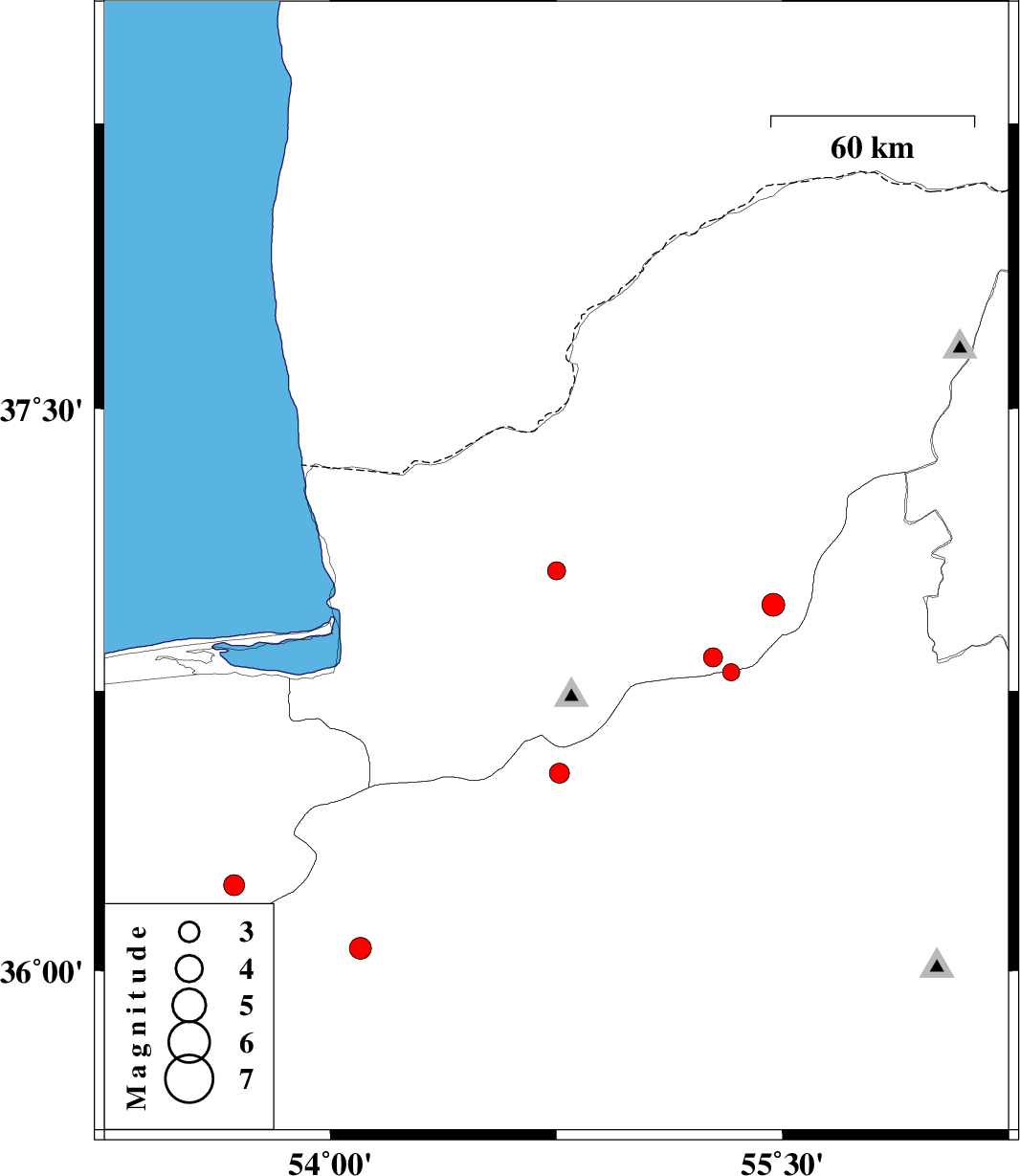
| Prel. Rep. | Date | Time(UTC) | Time(Local) | Lat. | Lon. | Depth | Mag. | Region | Waveform |
| 2015/05/06 | 22:37:56.1 | 03:07:56.1 | 37.07 | 54.75 | 31 | ML:2.7 | Golestan Province, 21 km North-West of Ali Abad | ||
| 2015/05/06 | 17:23:31.2 | 21:53:31.2 | 36.98 | 55.47 | 8 | ML:3.4 | Golestan Province, 29 km South of Minodasht | ||
| 2015/05/05 | 02:00:58.8 | 06:30:58.8 | 36.84 | 55.27 | 15 | ML:2.8 | Golestan Province, 22 km South-East of Ramian | ||
| 2015/04/15 | 02:50:01.8 | 07:20:01.8 | 36.8 | 55.33 | 15 | ML:2.6 | Semnan Province, 29 km South-East of Ramian | ||
| 2015/04/08 | 02:11:34.4 | 06:41:34.4 | 36.23 | 53.68 | 14 | ML:3.1 | Mazandaran Province, 53 km South-East of Behshahr | ||
| 2015/04/06 | 05:21:17.5 | 09:51:17.5 | 36.53 | 54.76 | 14 | ML:3 | Semnan Province, 23 km North-West of Shahrud | ||
| 2015/04/06 | 05:18:13.0 | 09:48:13.0 | 36.06 | 54.1 | 14 | ML:3.2 | Semnan Province, 26 km South-West of Damghan |