
Magnitude |
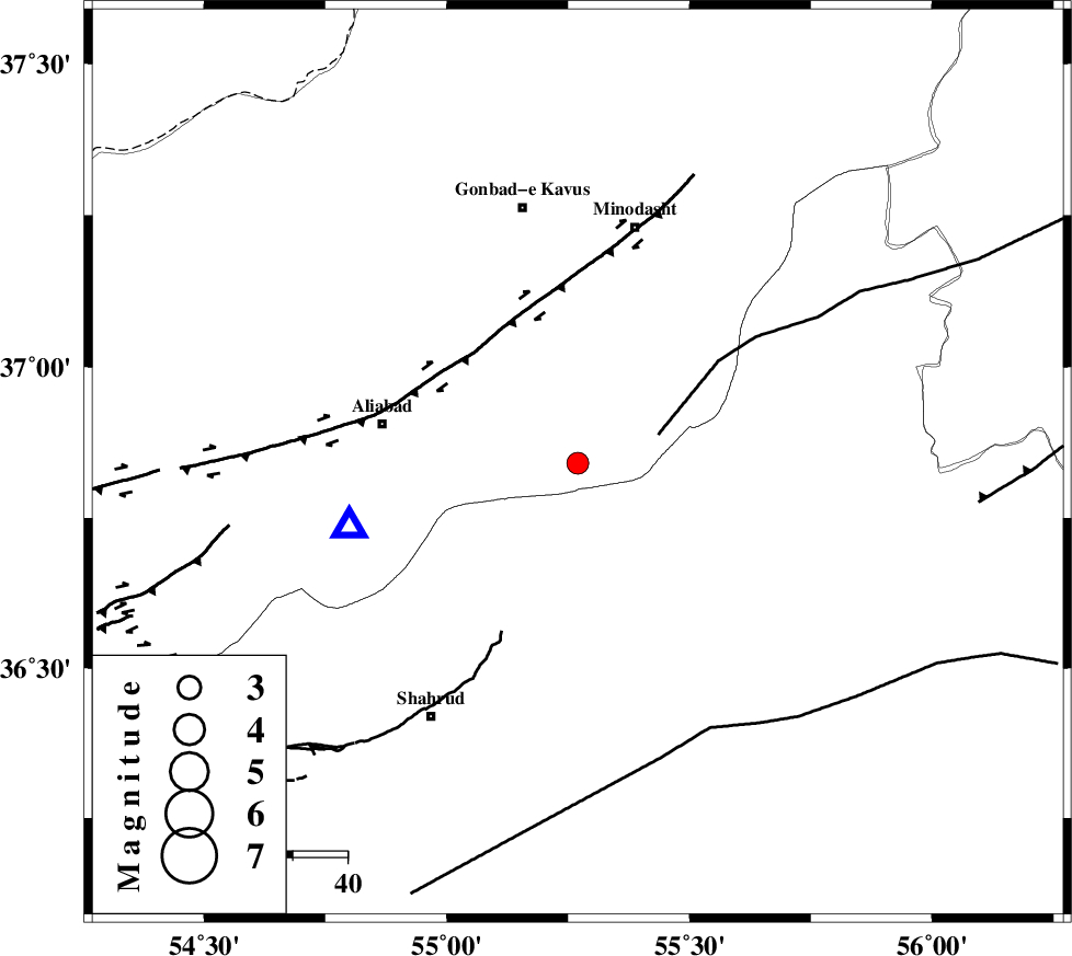
:2.8 |
| Date & Time (UTC) | 2015-05-05 02:00:58.8 |
| Date & Time (Local) | 1394/2/15 06:30:58.8 |
| Location | Lat:36.84 Lon: 55.27 |
| Region | Golestan Province, 22 km South-East of Ramian |
Nearest Cities |
|
| 18 km South West of Farsian, Golestan Province | |
| 19 km North of Kalateh khanj, Semnan Province | |
| 22 km South East of Ramian, Golestan Province | |
| 26 km South of Khanduz, Golestan Province | |
| 27 km North East of Qaleh-ye nokharqan, Semnan Province | |
| Depth | 15 km |
| Agency | |
Faults within 150 km: |
|
| SHAVAR_F (Length: 87 km) , Distance to epicenter: 9 km | |
| ROBATE_QARABIL_F (Length: 168 km) , Distance to epicenter: 16 km | |
| KHAZAR_F (Length: 523 km) , Distance to epicenter: 33 km | |
| Number of Phases | 3 |
| RMS | 0 |
| Number of Stations | 4 |
| Error in Latitude | >2.2 km |
| Error in Longitude | 2.1 km |
| Error in Depth | 0 km |
Download waveform in seisan format
to download seisan software Click here
to access information about IIEES stations Click here
Amplitude | ||||||||
| UID | Agency | Station | Component | Amplitude | Period | Arrival Time | Proccessing Time | Signal Clip |
| 95577 | IIEES | GHVR | N | 11.8 | 0.4 | 2015-05-05 02:03:19 | 2015-05-05 03:32:00 | n |
Phase | ||||||||||||
| Agency | Station | Component | Phase Type | Phase Quality | First Motion | Observed Arrival Time | Time Residual | Loc. Flag | Input Weight | Distance | Azimuth | |
| IIEES | SHRO | Z | Pg | E | 2015-05-05 02:01:17 | 0 | y | 114 | 144 | |||
| IIEES | BJRD | Z | Pg | E | 2015-05-05 02:01:33 | 0 | y | 212 | 63 | |||
| IIEES | DAMV | Z | Pn | E | 2015-05-05 02:01:47 | 0 | y | 326 | 247 | |||