
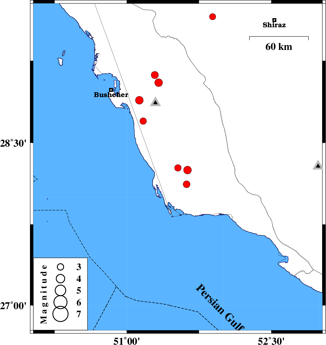
| Prel. Rep. | Date | Time(UTC) | Time(Local) | Lat. | Lon. | Depth | Mag. | Region | Waveform |
| 2015/04/09 | 21:39:57.6 | 02:09:57.6 | 29.65 | 51.89 | 21 | ML:2.9 | Fars Province, 23 km East of Kazerun | ||
| 2015/04/09 | 20:22:18.8 | 00:52:18.8 | 28.27 | 51.53 | 29 | ML:3.1 | Bushehr Province, 45 km South-East of Khormog | ||
| 2015/04/09 | 02:48:03.1 | 07:18:03.1 | 28.25 | 51.63 | 43 | ML:3.6 | Bushehr Province, 51 km South-East of Khormog | ||
| 2015/04/06 | 03:24:08.8 | 07:54:08.8 | 28.89 | 51.13 | 4 | ML:3.7 | Bushehr Province, 13 km West of Ahram | ||
| 2015/04/05 | 06:25:00.4 | 10:55:00.4 | 29.05 | 51.33 | 16 | ML:3.7 | Bushehr Province, 21 km North of Ahram | ||
| 2015/04/05 | 05:03:57.7 | 09:33:57.7 | 29.12 | 51.29 | 7 | ML:3.4 | Bushehr Province, 18 km South of Borazjan | ||
| 2015/04/03 | 13:09:06.6 | 17:39:06.6 | 28.7 | 51.17 | 8 | ML:3.1 | Bushehr Province, 20 km West of Khormog | ||
| 2015/04/03 | 11:58:17.0 | 16:28:17.0 | 28.12 | 51.62 | 32 | ML:3.2 | Bushehr Province, 54 km North-West of Bandar-e kangan |