
Magnitude |
:3.4 |
| Date & Time (UTC) | 2015-04-05 05:03:57.7 |
| Date & Time (Local) | 1394/1/16 09:33:57.7 |
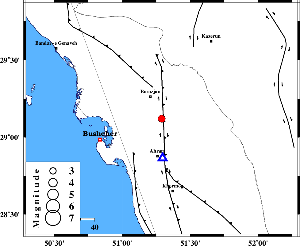
| Location | Lat:29.12 Lon: 51.29 |
| Region | Bushehr Province, 18 km South of Borazjan |
Nearest Cities |
|
| 11 km of Sarkareh, Bushehr Province | |
| 18 km South of Borazjan, Bushehr Province | |
| 20 km North of Bazuei, Bushehr Province | |
| 26 km North West of Kalameh, Bushehr Province | |
| 27 km North of Ahram, Bushehr Province | |
| Depth | 7 km |
| Agency | |
Faults within 150 km: |
|
| BORAZJAN_F (Length: 168 km) , Distance to epicenter: 9 km | |
| ZFF3 (Length: 125 km) , Distance to epicenter: 23 km | |
| ZFF2 (Length: 84 km) , Distance to epicenter: 32 km | |
| Number of Phases | 7 |
| RMS | 0.1 |
| Number of Stations | 6 |
| Error in Latitude | >3.2 km |
| Error in Longitude | 5.2 km |
| Error in Depth | 8.3 km |
Download waveform in seisan format
to download seisan software Click here
to access information about IIEES stations Click here
Amplitude | ||||||||
| UID | Agency | Station | Component | Amplitude | Period | Arrival Time | Proccessing Time | Signal Clip |
| 95330 | IIEES | SHGR | E | 63.6 | 0.57 | 2015-04-05 05:06:06 | 2015-04-05 06:09:00 | n |
Phase | ||||||||||||
| Agency | Station | Component | Phase Type | Phase Quality | First Motion | Observed Arrival Time | Time Residual | Loc. Flag | Input Weight | Distance | Azimuth | |
| IIEES | AHRM | Z | Pg | E | 2015-04-05 05:04:02 | -0.01 | y | 28.2 | 178 | |||
| IIEES | AHRM | E | Sg | E | 2015-04-05 05:04:06 | -0.02 | y | 28.2 | 178 | |||
| IIEES | NASN | Z | Pn | E | 2015-04-05 05:05:00 | -0.12 | y | 433 | 19 | |||
| IIEES | NASN | N | S | E | 2015-04-05 05:05:46 | -0.06 | y | 433 | 19 | |||
| IIEES | KHMZ | Z | Pn | E | 2015-04-05 05:05:12 | 0.15 | y | 528 | 347 | |||
| IIEES | KRBR | Z | Pn | E | 2015-04-05 05:05:13 | 0.13 | y | 539 | 78 | |||
| IIEES | DAMV | Z | Pn | E | 2015-04-05 05:05:36 | -0.02 | y | 725 | 5 | |||