| Prel. Rep. | Date | Time(UTC) | Time(Local) | Lat. | Lon. | Depth | Mag. | Region | Waveform |
|
|
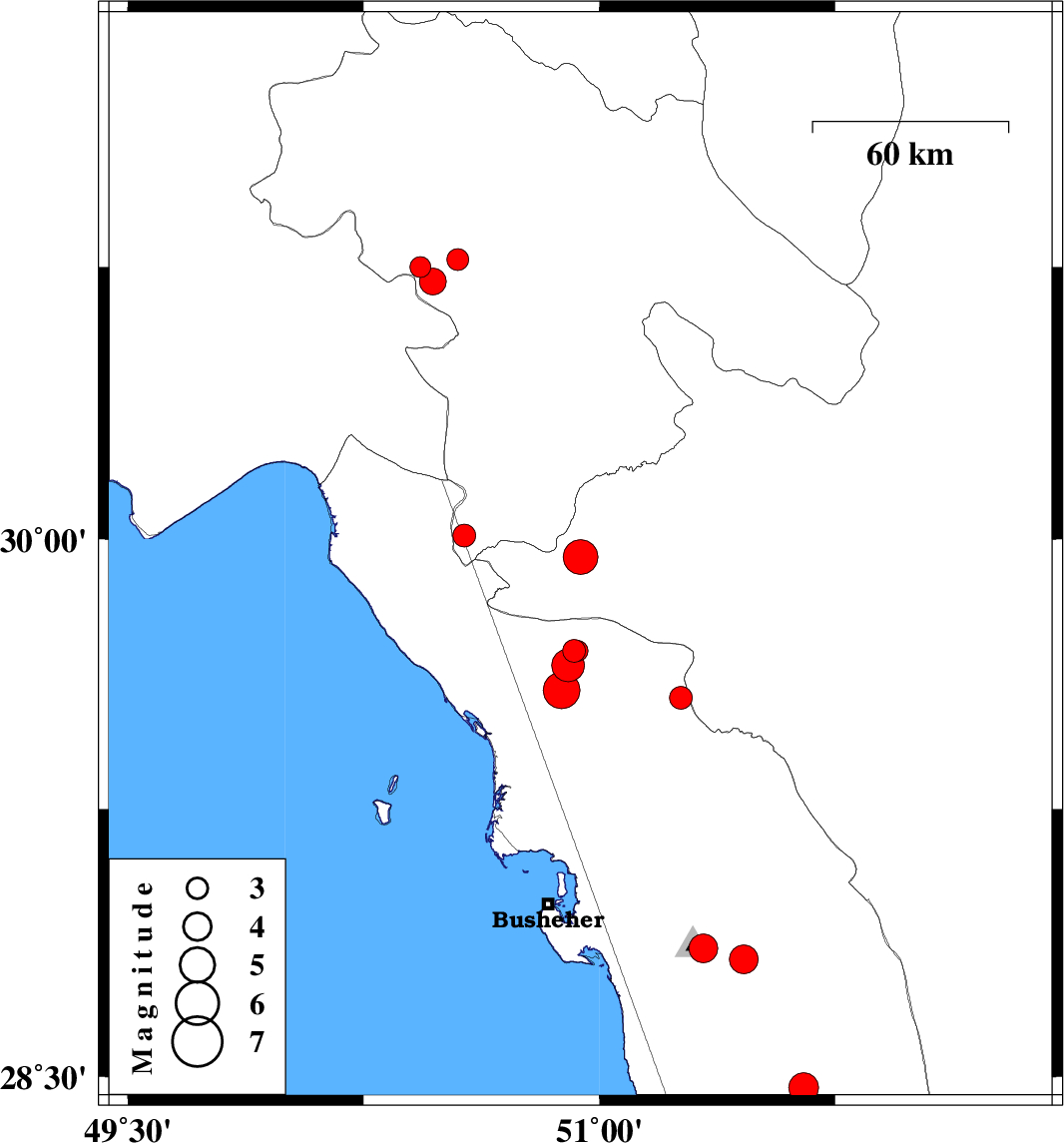
2014/06/20
|
22:54:20.6
|
03:24:20.6
| 29.95 | 50.94 | 6 |
ML:5
|
Fars Province, 47 km South-East of Dogonbadan | |
|
|
2014/06/20
|
02:54:01.3
|
07:24:01.3
| 28.83 | 51.46 | 15 |
ML:4.1
|
Bushehr Province, 21 km East of Ahram | |
|
|
2014/06/17
|
13:43:14.7
|
18:13:14.7
| 30.75 | 50.43 | 14 |
ML:3
|
Kohkiluieh va boyerahmad Province, 14 km West of Dehdasht | |
|
|
2014/06/17
|
12:51:17.0
|
17:21:17.0
| 28.47 | 51.65 | 18 |
ML:4.2
|
Bushehr Province, 34 km South-East of Khormog | |
|
|
2014/06/17
|
06:38:41.5
|
11:08:41.5
| 30.01 | 50.57 | 42 |
ML:3.3
|
Kohkiluieh va boyerahmad Province, 48 km North of Bandar-e genaveh | |
|
|
2014/06/15
|
23:40:09.1
|
04:10:09.1
| 30.77 | 50.55 | 14 |
ML:3.1
|
Kohkiluieh va boyerahmad Province, 2 km Dehdasht | |
|
|
2014/06/15
|
23:24:46.9
|
03:54:46.9
| 30.71 | 50.47 | 18 |
ML:3.8
|
Kohkiluieh va boyerahmad Province, 12 km Dehdasht | |
|
|
2014/06/07
|
02:43:30.4
|
07:13:30.4
| 28.86 | 51.33 | 16 |
ML:4.1
|
Bushehr Province, 7 km Ahram | |
|
|
2014/05/25
|
12:42:10.7
|
17:12:10.7
| 29.56 | 51.26 | 11 |
ML:3.3
|
Bushehr Province, 33 km North of Borazjan | |
|
|
2014/05/23
|
05:26:48.4
|
09:56:48.4
| 29.69 | 50.92 | 14 |
ML:3.3
|
Bushehr Province, 42 km North-East of Bandar-e genaveh | |
|
|
2014/05/22
|
18:01:27.7
|
22:31:27.7
| 29.69 | 50.93 | 18 |
ML:2.9
|
Bushehr Province, 42 km North-East of Bandar-e genaveh | |
|
|
2014/05/21
|
13:25:22.1
|
17:55:22.1
| 29.65 | 50.9 | 18 |
ML:4.6
|
Bushehr Province, 38 km East of Bandar-e genaveh | |
|
|
2014/05/21
|
09:46:29.1
|
14:16:29.1
| 29.58 | 50.88 | 18 |
ML:5.2
|
Bushehr Province, 35 km East of Bandar-e genaveh | |
