
| Prel. Rep. | Date | Time(UTC) | Time(Local) | Lat. | Lon. | Depth | Mag. | Region | Waveform |
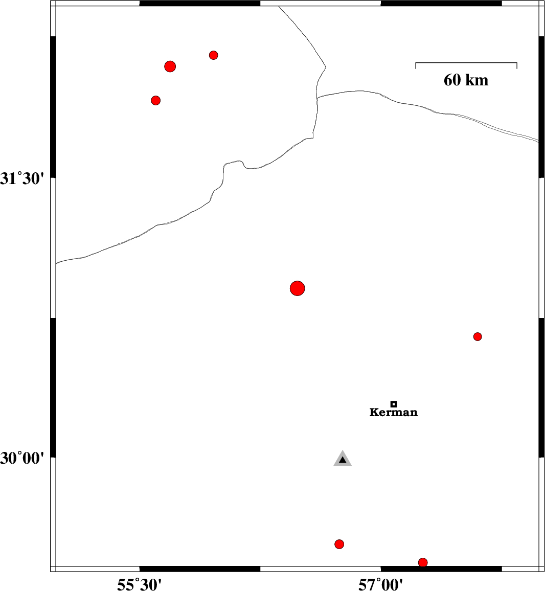
| 2014/04/05 | 12:16:32.0 | 16:46:32.0 | 30.91 | 56.48 | 14 | ML:4.1 | Kerman Province, 14 km Zarand | ||
| 2014/04/04 | 22:24:15.3 | 02:54:15.3 | 32.15 | 55.96 | 15 | ML:2.4 | Yazd Province, 81 km North-East of Bafq | ||
| 2014/04/03 | 22:13:44.7 | 02:43:44.7 | 29.43 | 57.26 | 14 | ML:2.6 | Kerman Province, 67 km North-East of Baft | ||
| 2014/04/03 | 11:57:32.9 | 16:27:32.9 | 31.91 | 55.6 | 16 | ML:2.5 | Yazd Province, 39 km North-East of Bafq | ||
| 2014/04/01 | 15:00:21.8 | 19:30:21.8 | 30.65 | 57.6 | 18 | ML:2.2 | Kerman Province, 64 km North-East of Kerman | ||
| 2014/03/31 | 21:52:52.0 | 02:22:52.0 | 32.09 | 55.69 | 14 | ML:3.1 | Yazd Province, 60 km North-East of Bafq | ||
| 2014/03/30 | 06:45:38.8 | 11:15:38.8 | 29.53 | 56.74 | 12 | ML:2.5 | Kerman Province, 35 km North-East of Baft |