
| Prel. Rep. | Date | Time(UTC) | Time(Local) | Lat. | Lon. | Depth | Mag. | Region | Waveform |
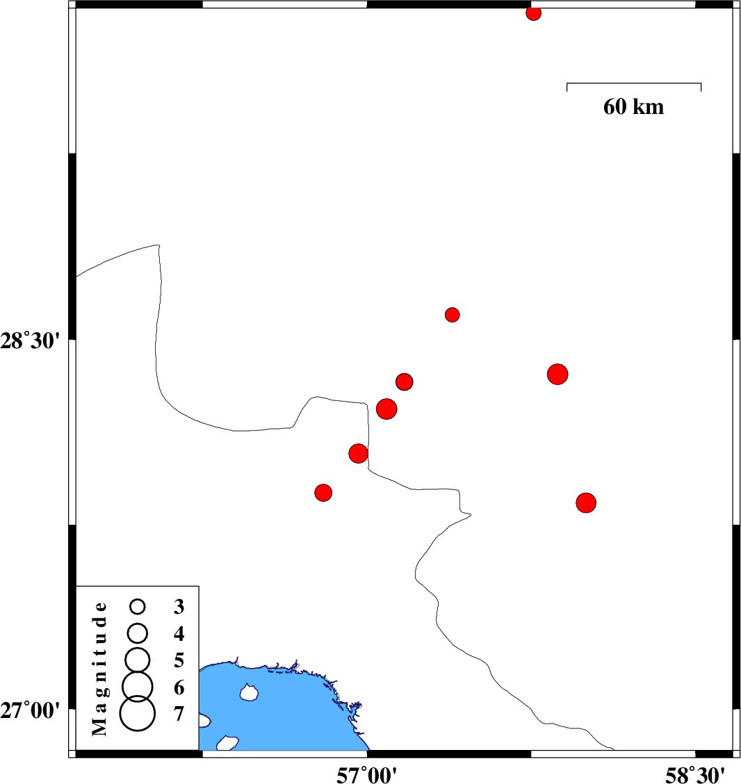
| 2014/03/20 | 21:15:36.0 | 00:45:36.0 | 28.33 | 57.17 | 15 | ML:3.4 | Kerman Province, 66 km North-West of Kahnuj | ||
| 2014/03/16 | 14:34:43.9 | 18:04:43.9 | 28.36 | 57.87 | 15 | ML:4.2 | Kerman Province, 37 km South-East of Jiroft | ||
| 2014/03/12 | 20:22:00.5 | 23:52:00.5 | 28.22 | 57.09 | 14 | ML:4.3 | Kerman Province, 67 km North-West of Kahnuj | ||
| 2014/03/02 | 04:11:56.8 | 07:41:56.8 | 28.33 | 57.17 | 14 | ML:3.5 | Kerman Province, 67 km North-West of Kahnuj | ||
| 2014/02/26 | 08:08:05.6 | 11:38:05.6 | 27.84 | 58 | 43 | ML:4.1 | Kerman Province, 33 km South-East of Kahnuj | ||
| 2014/02/25 | 19:14:22.8 | 22:44:22.8 | 27.88 | 56.8 | 18 | ML:3.5 | Hormozgan Province, 67 km North-West of Dehbarez | ||
| 2014/02/22 | 17:29:10.6 | 20:59:10.6 | 28.04 | 56.96 | 14 | ML:3.9 | Hormozgan Province, 73 km West of Kahnuj | ||
| 2014/02/21 | 10:57:27.4 | 14:27:27.4 | 29.81 | 57.76 | 42 | ML:3.1 | Kerman Province, 127 km North of Jiroft | ||
| 2014/02/20 | 10:06:46.1 | 13:36:46.1 | 28.6 | 57.39 | 18 | ML:3 | Kerman Province, 35 km West of Jiroft |