
Magnitude |
:4.1 |
| Date & Time (UTC) | 2014-02-26 08:08:05.6 |
| Date & Time (Local) | 1392/12/7 11:38:05.6 |
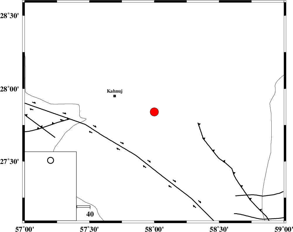
| Location | Lat:27.84 Lon: 58 |
| Region | Kerman Province, 33 km South-East of Kahnuj |
Nearest Cities |
|
| 32 km South East of Kahnuj, Kerman Province | |
| 37 km North East of Qalehy-eganj, Kerman Province | |
| 41 km North East of Bargah, Kerman Province | |
| 55 km South West of Borj-e abbasabad, Kerman Province | |
| 59 km South West of Mardehak, Kerman Province | |
| Depth | 43 km |
| Agency | |
Faults within 150 km: |
|
| JIROFT_F (Length: 144 km) , Distance to epicenter: 19 km | |
| SABZEVARAN_F (Length: 190 km) , Distance to epicenter: 33 km | |
| BAM_F (Length: 118 km) , Distance to epicenter: 92 km | |
| Number of Phases | 8 |
| RMS | 0.2 |
| Number of Stations | 8 |
| Error in Latitude | >3.3 km |
| Error in Longitude | 5.3 km |
| Error in Depth | 5.7 km |
Download waveform in seisan format
to download seisan software Click here
to access information about IIEES stations Click here
Amplitude | ||||||||
| UID | Agency | Station | Component | Amplitude | Period | Arrival Time | Proccessing Time | Signal Clip |
| 91885 | IIEES | KRBR | E | 899.1 | 0.15 | 2014-02-26 08:09:21 | 2014-02-26 08:42:00 | n |
Phase | ||||||||||||
| Agency | Station | Component | Phase Type | Phase Quality | First Motion | Observed Arrival Time | Time Residual | Loc. Flag | Input Weight | Distance | Azimuth | |
| IIEES | KRBR | N | Sg | E | 2014-02-26 08:09:19 | 0 | y | 266 | 333 | |||
| IIEES | CHBR | Z | Pn | E | 2014-02-26 08:08:54 | 0 | y | 350 | 135 | |||
| IIEES | BSRN | Z | Pn | E | 2014-02-26 08:09:09 | -0.03 | y | 470 | 13 | |||
| IIEES | YZKH | Z | Pn | E | 2014-02-26 08:09:26 | 0.33 | y | 602 | 328 | |||
| IIEES | TABS | Z | Pn | E | 2014-02-26 08:09:31 | -0.18 | y | 650 | 353 | |||
| IIEES | SHRT | Z | P | E | 2014-02-26 08:09:35 | 0.07 | y | 680 | 18 | |||
| IIEES | KHMZ | Z | Pn | E | 2014-02-26 08:10:15 | -0.44 | y | 1009 | 312 | |||
| IIEES | ASAO | Z | Pn | E | 2014-02-26 08:10:22 | -0.12 | y | 1063 | 316 | |||