
| Prel. Rep. | Date | Time(UTC) | Time(Local) | Lat. | Lon. | Depth | Mag. | Region | Waveform |
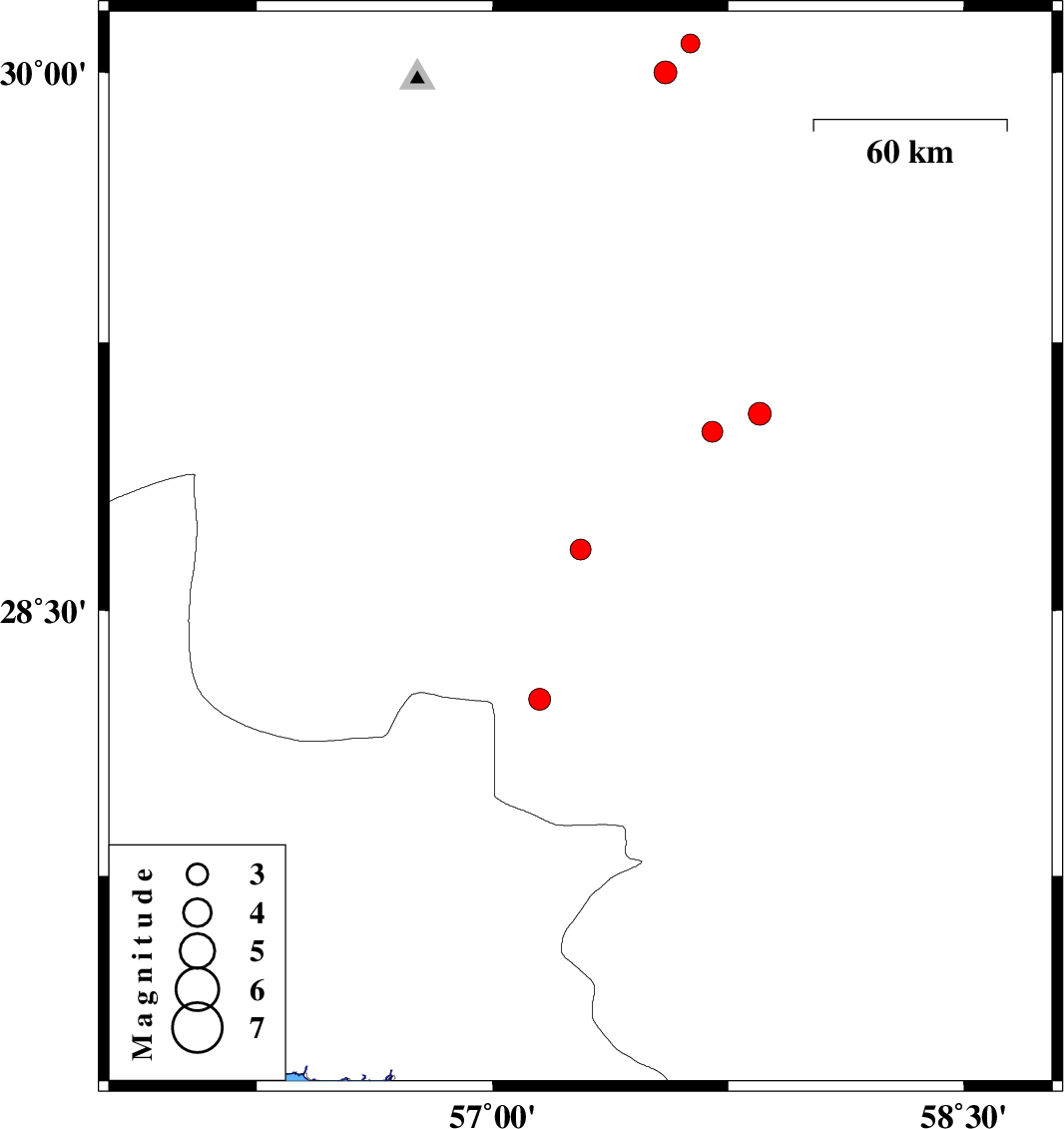
| 2013/12/30 | 01:38:17.0 | 05:08:17.0 | 28.67 | 57.28 | 17 | ML:2.9 | Kerman Province, 45 km West of Jiroft | ||
| 2013/12/28 | 11:43:57.6 | 15:13:57.6 | 30.08 | 57.63 | 14 | ML:2.7 | Kerman Province, 58 km South-East of Kerman | ||
| 2013/12/28 | 07:35:12.4 | 11:05:12.4 | 28.25 | 57.15 | 15 | ML:3.1 | Kerman Province, 64 km North-West of Kahnuj | ||
| 2013/12/28 | 04:04:08.2 | 07:34:08.2 | 29 | 57.7 | 14 | ML:2.9 | Kerman Province, 37 km North of Jiroft | ||
| 2013/12/24 | 10:53:58.9 | 14:23:58.9 | 29.05 | 57.85 | 18 | ML:3.3 | Kerman Province, 43 km North-East of Jiroft | ||
| 2013/12/23 | 06:11:07.9 | 09:41:07.9 | 30 | 57.55 | 14 | ML:3.2 | Kerman Province, 56 km South-East of Kerman |