
Magnitude |
:2.9 |
| Date & Time (UTC) | 2013-12-28 04:04:08.2 |
| Date & Time (Local) | 1392/10/7 07:34:08.2 |
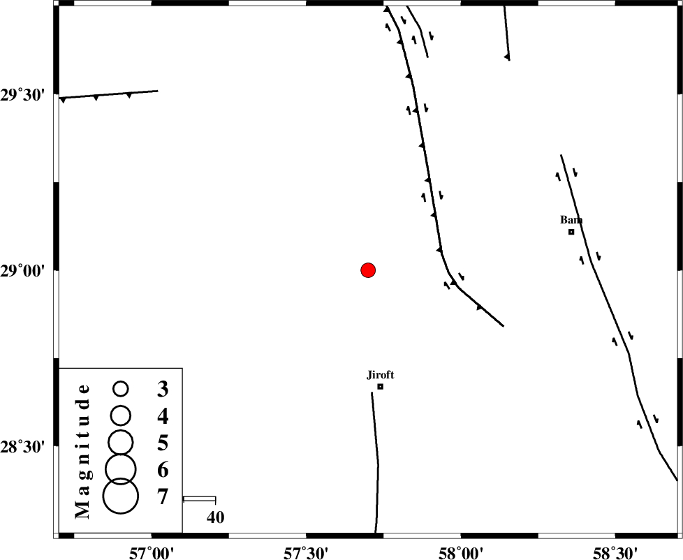
| Location | Lat:29 Lon: 57.7 |
| Region | Kerman Province, 37 km North of Jiroft |
Nearest Cities |
|
| 9 km North of Delfard, Kerman Province | |
| 14 km East of Sahebabad, Kerman Province | |
| 24 km North West of Mohammadabad, Kerman Province | |
| 26 km North West of Saghdar, Kerman Province | |
| 35 km East of Eslamabad, Kerman Province | |
| Depth | 14 km |
| Agency | |
Faults within 150 km: |
|
| GOWK_F (Length: 152 km) , Distance to epicenter: 24 km | |
| SABZEVARAN_F (Length: 190 km) , Distance to epicenter: 39 km | |
| GOLBAF_SIRCH_F (Length: 114 km) , Distance to epicenter: 70 km | |
| Number of Phases | 5 |
| RMS | 0.2 |
| Number of Stations | 4 |
| Error in Latitude | >6.1 km |
| Error in Longitude | 4.8 km |
| Error in Depth | 9.8 km |
Download waveform in seisan format
to download seisan software Click here
to access information about IIEES stations Click here
Amplitude | ||||||||
| UID | Agency | Station | Component | Amplitude | Period | Arrival Time | Proccessing Time | Signal Clip |
| 91288 | IIEES | KRBR | N | 212.4 | 0.16 | 2013-12-28 04:04:54 | 2013-12-28 05:00:00 | n |
| 91289 | IIEES | KRBR | E | 207.3 | 0.12 | 2013-12-28 04:04:55 | 2013-12-28 05:00:00 | n |
Phase | ||||||||||||
| Agency | Station | Component | Phase Type | Phase Quality | First Motion | Observed Arrival Time | Time Residual | Loc. Flag | Input Weight | Distance | Azimuth | |
| IIEES | KRBR | Z | Pg | E | 2013-12-28 04:04:31 | -0.22 | y | 142 | 320 | |||
| IIEES | ZHSF | Z | Pn | E | 2013-12-28 04:04:53 | -0.17 | y | 306 | 77 | |||
| IIEES | BSRN | Z | Pn | E | 2013-12-28 04:05:00 | 0.28 | y | 356 | 22 | |||
| IIEES | BSRN | N | Sg | E | 2013-12-28 04:05:47 | -0.12 | y | 356 | 22 | |||
| IIEES | TABS | Z | Pn | E | 2013-12-28 04:05:20 | 0.39 | y | 518 | 354 | |||