
| Prel. Rep. | Date | Time(UTC) | Time(Local) | Lat. | Lon. | Depth | Mag. | Region | Waveform |
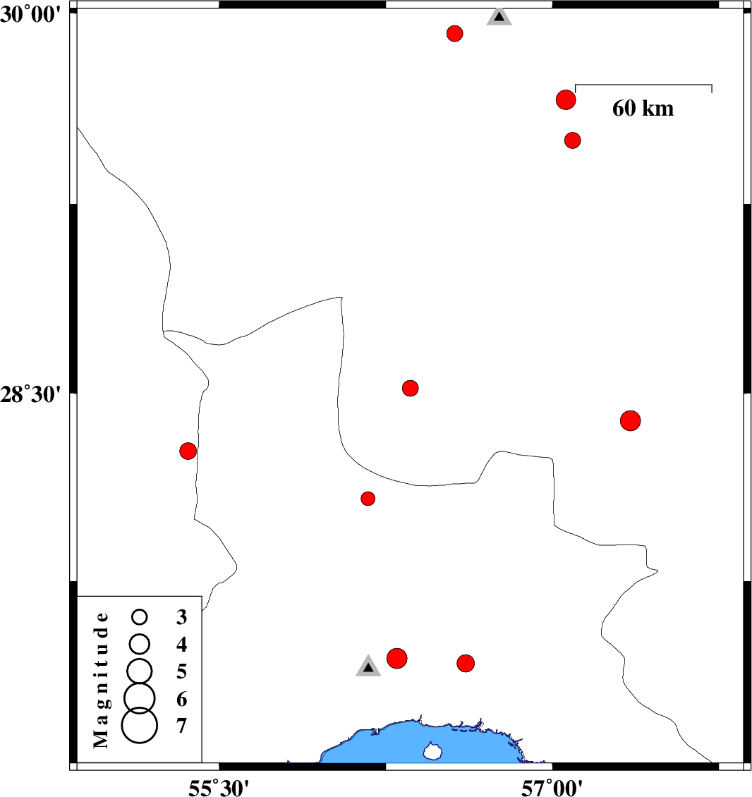
| 2013/03/06 | 13:16:23.2 | 16:46:23.2 | 28.52 | 56.36 | 14 | ML:3.2 | Kerman Province, 50 km North-East of Hajiabad | ||
| 2013/03/04 | 14:29:53.2 | 17:59:53.2 | 27.42 | 56.61 | 15 | ML:3.5 | Hormozgan Province, 42 km North-East of Bandar-e abbas | ||
| 2013/02/22 | 01:54:32.6 | 05:24:32.6 | 29.5 | 57.09 | 14 | ML:3.3 | Kerman Province, 56 km North-East of Baft | ||
| 2013/02/22 | 01:39:24.4 | 05:09:24.4 | 29.66 | 57.06 | 16 | ML:4 | Kerman Province, 70 km South of Kerman | ||
| 2013/02/21 | 02:08:25.6 | 05:38:25.6 | 28.08 | 56.17 | 17 | ML:2.8 | Hormozgan Province, 37 km South-East of Hajiabad | ||
| 2013/02/20 | 18:59:42.2 | 22:29:42.2 | 28.27 | 55.36 | 14 | ML:3.4 | Fars Province, 53 km West of Hajiabad | ||
| 2013/02/20 | 08:41:32.5 | 12:11:32.5 | 29.92 | 56.56 | 14 | ML:3.3 | Kerman Province, 1 km Bardsir | ||
| 2013/02/16 | 13:09:05.1 | 16:39:05.1 | 28.39 | 57.35 | 14 | ML:4.1 | Kerman Province, 49 km South-West of Jiroft | ||
| 2013/02/07 | 13:42:09.1 | 17:12:09.1 | 27.44 | 56.3 | 15 | ML:4.1 | Hormozgan Province, 29 km North of Bandar-e abbas |