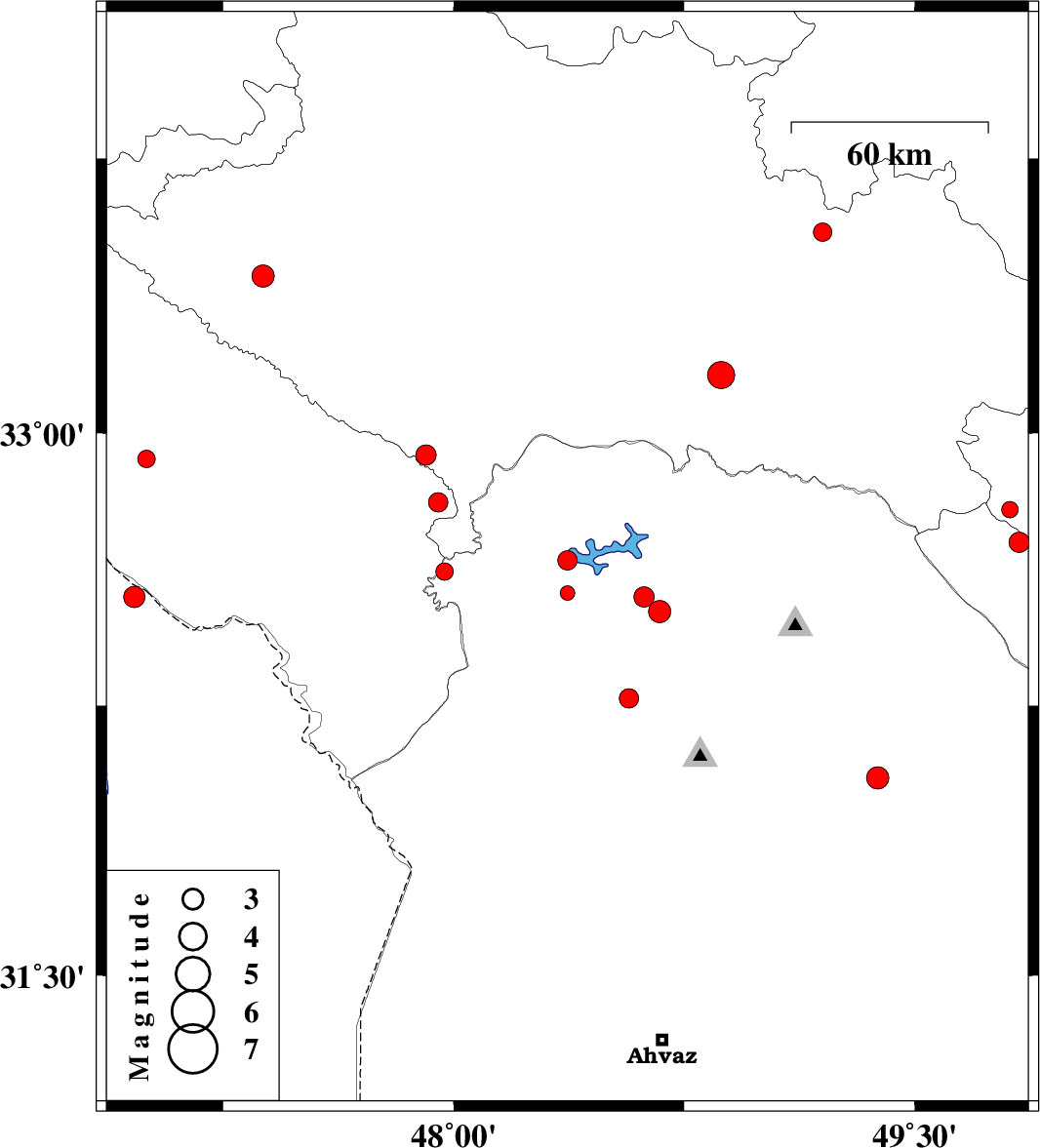
| Prel. Rep. | Date | Time(UTC) | Time(Local) | Lat. | Lon. | Depth | Mag. | Region | Waveform |
|
|
2012/08/16
|
18:57:00.4
|
23:27:00.4
| 32.65 | 48.37 | 33 |
ML:2.8
|
Khoozestan Province, 21 km North of Andimeshk | |
|
|
2012/08/14
|
11:40:44.7
|
16:10:44.7
| 32.93 | 47 | 43 |
ML:2.6
|
Ilam Province, 44 km West of Abdanan | |
|
|
2012/08/08
|
04:03:35.9
|
08:33:35.9
| 33.43 | 47.38 | 14 |
ML:3.3
|
Lorestan Province, 24 km West of Kuhdasht | |
|
|
2012/08/07
|
03:25:01.5
|
07:55:01.5
| 32.55 | 48.62 | 14 |
ML:3
|
Khoozestan Province, 27 km East of Andimeshk | |
|
|
2012/08/06
|
22:48:32.0
|
03:18:32.0
| 32.62 | 47.97 | 14 |
ML:2.5
|
Ilam Province, 40 km North-West of Andimeshk | |
|
|
2012/08/06
|
00:19:07.3
|
04:49:07.3
| 32.27 | 48.57 | 14 |
ML:2.8
|
Khoozestan Province, 20 km South-East of Dezful | |
|
|
2012/08/02
|
22:18:10.3
|
02:48:10.3
| 32.56 | 48.37 | 18 |
ML:2.1
|
Khoozestan Province, 11 km North of Andimeshk | |
|
|
2012/07/29
|
21:56:08.7
|
02:26:08.7
| 32.81 | 47.95 | 17 |
ML:2.8
|
Ilam Province, 44 km South-East of Pol-e dokhtar | |
|
|
2012/07/28
|
06:09:54.6
|
10:39:54.6
| 32.55 | 46.96 | 14 |
ML:3.1
|
Iraq, 32 km South-West of Dehloran | |
|
|
2012/07/25
|
10:05:26.0
|
14:35:26.0
| 32.51 | 48.67 | 14 |
ML:3.3
|
Khoozestan Province, 31 km East of Andimeshk | |
|
|
2012/07/24
|
16:22:39.5
|
20:52:39.5
| 32.94 | 47.91 | 14 |
ML:3
|
Lorestan Province, 30 km South-East of Pol-e dokhtar | |
|
|
2012/07/24
|
07:25:34.2
|
11:55:34.2
| 33.55 | 49.2 | 6 |
ML:2.7
|
Lorestan Province, 14 km East of Dorud | |
|
|
2012/07/23
|
12:53:02.2
|
17:23:02.2
| 32.79 | 49.81 | 7 |
ML:2.4
|
Esfahan Province, 33 km South-West of Fereydunshahr | |
|
|
2012/07/23
|
10:43:34.3
|
15:13:34.3
| 32.7 | 49.84 | 18 |
ML:2.9
|
Chaharmahal Bakhtiari Province, 36 km South-West of Fereydunshahr | |
|
|
2012/07/23
|
08:31:41.6
|
13:01:41.6
| 33.16 | 48.87 | 14 |
ML:4
|
Lorestan Province, 41 km South-West of Dorud | |
|
|
2012/07/18
|
11:04:51.7
|
15:34:51.7
| 32.05 | 49.38 | 37 |
ML:3.2
|
Khoozestan Province, 14 km North of Masjed Soleyman | |
