
Magnitude |
:2.5 |
| Date & Time (UTC) | 2012-08-06 22:48:32.0 |
| Date & Time (Local) | 1391/5/17 03:18:32.0 |
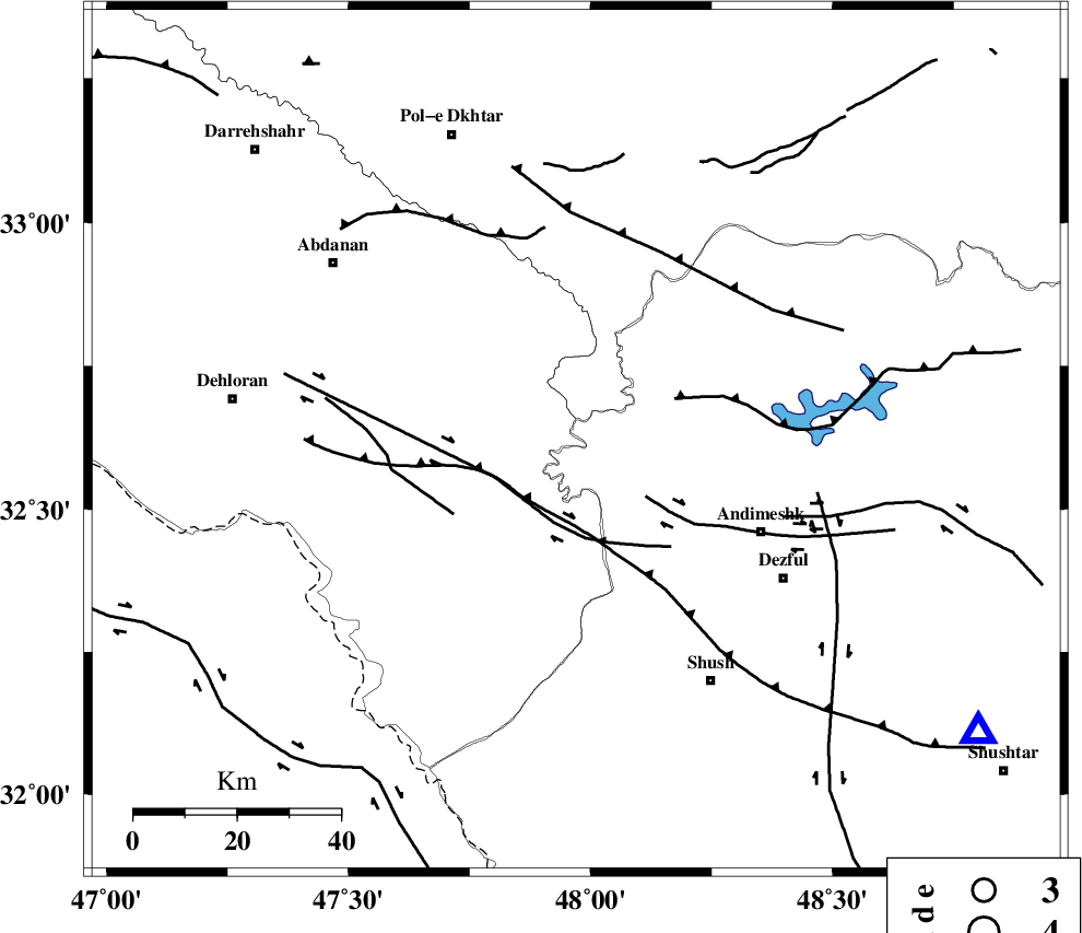
| Location | Lat:32.62 Lon: 47.97 |
| Region | Ilam Province, 40 km North-West of Andimeshk |
Nearest Cities |
|
| 27 km West of Hoseinieh, Khoozestan Province | |
| 29 km South West of Bidruyeh, Khoozestan Province | |
| 38 km South West of Sorkhakan, Khoozestan Province | |
| 40 km North West of Andimeshk, Khoozestan Province | |
| 48 km North West of Dezful, Khoozestan Province | |
| Depth | 14 km |
| Agency | |
Faults within 150 km: |
|
| BALARUD_F_Z1 (Length: 87 km) , Distance to epicenter: 16 km | |
| DEZFUL_EMBAYMENT (Length: 228 km) , Distance to epicenter: 17 km | |
| BALARUD_F_Z3 (Length: 53 km) , Distance to epicenter: 25 km | |
| Number of Phases | 6 |
| RMS | 0.2 |
| Number of Stations | 5 |
| Error in Latitude | >3.8 km |
| Error in Longitude | 6.5 km |
| Error in Depth | 9.3 km |
Download waveform in seisan format
to download seisan software Click here
to access information about IIEES stations Click here
Amplitude | ||||||||
| UID | Agency | Station | Component | Amplitude | Period | Arrival Time | Proccessing Time | Signal Clip |
| 84816 | IIEES | SHGR | N | 150.3 | 0.36 | 2012-08-06 22:49:11 | 2012-08-06 11:10:00 | n |
| 84817 | IIEES | SHGR | E | 174.9 | 0.32 | 2012-08-06 22:49:11 | 2012-08-06 11:10:00 | n |
| 84818 | IIEES | KHMZ | E | 32.5 | 0.36 | 2012-08-06 22:49:40 | 2012-08-06 11:10:00 | n |
| 84819 | IIEES | KHMZ | N | 31.4 | 0.64 | 2012-08-06 22:49:43 | 2012-08-06 11:10:00 | n |
| 84820 | IIEES | SNGE | E | 21.3 | 0.72 | 2012-08-06 22:49:56 | 2012-08-06 11:10:00 | n |
| 84821 | IIEES | ASAO | E | 22.5 | 0.6 | 2012-08-06 22:50:02 | 2012-08-06 11:10:00 | n |
Phase | ||||||||||||
| Agency | Station | Component | Phase Type | Phase Quality | First Motion | Observed Arrival Time | Time Residual | Loc. Flag | Input Weight | Distance | Azimuth | |
| IIEES | SHGR | Z | Pg | E | 2012-08-06 22:48:48 | -0.13 | y | 96.6 | 126 | |||
| IIEES | KHMZ | Z | Pn | E | 2012-08-06 22:49:08 | 0.44 | y | 223 | 56 | |||
| IIEES | KHMZ | N | Sg | E | 2012-08-06 22:49:35 | -0.16 | y | 223 | 56 | |||
| IIEES | SNGE | Z | Pn | E | 2012-08-06 22:49:14 | -0.21 | y | 280 | 348 | |||
| IIEES | ASAO | Z | Pn | E | 2012-08-06 22:49:15 | 0.14 | y | 286 | 41 | |||
| IIEES | GHVR | Z | Pn | E | 2012-08-06 22:49:25 | -0.11 | y | 367 | 55 | |||