
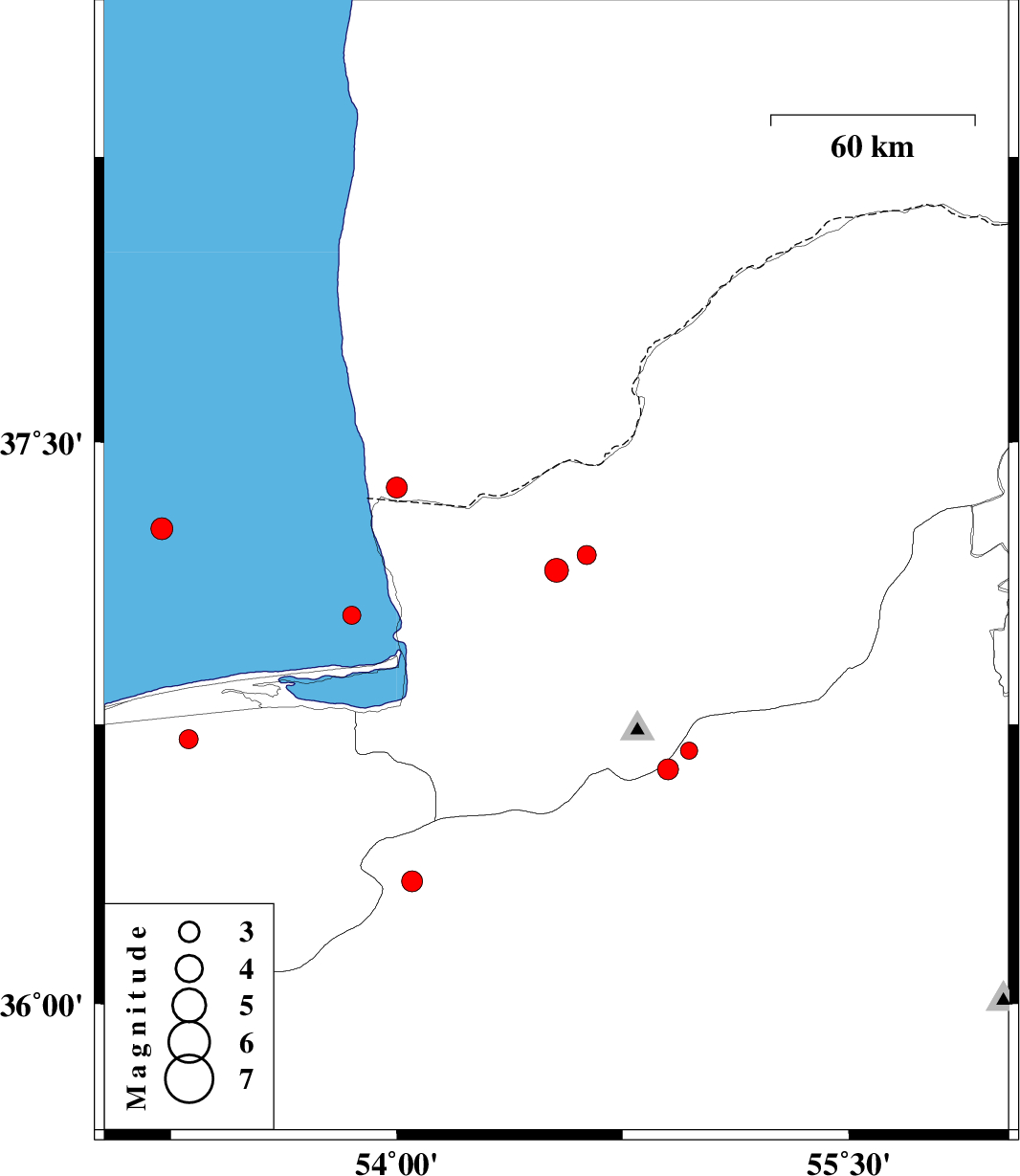
| Prel. Rep. | Date | Time(UTC) | Time(Local) | Lat. | Lon. | Depth | Mag. | Region | Waveform |
| 2012/04/12 | 15:01:41.3 | 19:31:41.3 | 37.16 | 54.53 | 14 | ML:3.5 | Golestan Province, 18 km North of Aq Qaleh | ||
| 2012/04/10 | 17:19:31.2 | 21:49:31.2 | 37.04 | 53.85 | 14 | ML:2.7 | Caspian Sea, 25 km North-West of Bandar-e torkaman | ||
| 2012/04/09 | 09:23:46.3 | 13:53:46.3 | 37.2 | 54.63 | 28 | ML:2.8 | Golestan Province, 26 km North-East of Aq Qaleh | ||
| 2012/04/09 | 05:07:12.5 | 09:37:12.5 | 36.68 | 54.97 | 14 | ML:2.6 | Semnan Province, 29 km North of Shahrud | ||
| 2012/03/20 | 13:16:17.5 | 16:46:17.5 | 36.71 | 53.31 | 14 | ML:2.8 | Mazandaran Province, 7 km Neka | ||
| 2012/03/19 | 03:03:24.2 | 06:33:24.2 | 37.38 | 54 | 14 | ML:3.1 | 54 km North of Bandar-e torkaman | ||
| 2012/03/19 | 02:05:13.5 | 05:35:13.5 | 36.63 | 54.9 | 18 | ML:3.1 | Semnan Province, 24 km North of Shahrud | ||
| 2012/03/14 | 02:34:02.1 | 06:04:02.1 | 36.33 | 54.05 | 14 | ML:3.1 | Semnan Province, 32 km North-West of Damghan | ||
| 2012/03/13 | 04:45:37.8 | 08:15:37.8 | 37.27 | 53.22 | 14 | ML:3.3 | Caspian Sea, 70 km North of Neka |