
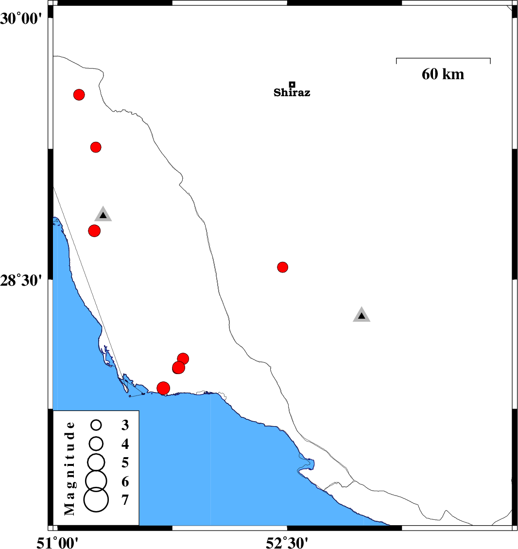
| Prel. Rep. | Date | Time(UTC) | Time(Local) | Lat. | Lon. | Depth | Mag. | Region | Waveform |
| 2012/03/29 | 06:16:47.2 | 10:46:47.2 | 28.57 | 52.47 | 7 | ML:3.1 | Fars Province, 31 km South-West of Firuz Abad | ||
| 2012/03/29 | 04:30:55.5 | 09:00:55.5 | 29.56 | 51.14 | 14 | ML:3.2 | Bushehr Province, 34 km North of Borazjan | ||
| 2012/03/28 | 14:27:59.3 | 18:57:59.3 | 29.26 | 51.25 | 18 | ML:3.1 | Bushehr Province, 4 km Borazjan | ||
| 2012/03/25 | 12:15:00.1 | 16:45:00.1 | 28.78 | 51.24 | 11 | ML:3.5 | Bushehr Province, 11 km Ahram | ||
| 2012/03/23 | 07:50:09.8 | 12:20:09.8 | 27.99 | 51.79 | 39 | ML:3.7 | Bushehr Province, 33 km North-West of Bandar-e kangan | ||
| 2012/03/22 | 16:39:08.2 | 21:09:08.2 | 27.87 | 51.69 | 43 | ML:3.8 | Bushehr Province, 37 km West of Bandar-e kangan | ||
| 2012/03/22 | 02:06:14.1 | 06:36:14.1 | 27.98 | 51.78 | 38 | ML:2.7 | Bushehr Province, 32 km North-West of Bandar-e kangan | ||
| 2012/03/22 | 01:50:45.1 | 06:20:45.1 | 28.04 | 51.82 | 36 | ML:3.4 | Bushehr Province, 33 km North-West of Bandar-e kangan |