| Prel. Rep. | Date | Time(UTC) | Time(Local) | Lat. | Lon. | Depth | Mag. | Region | Waveform |
|
|
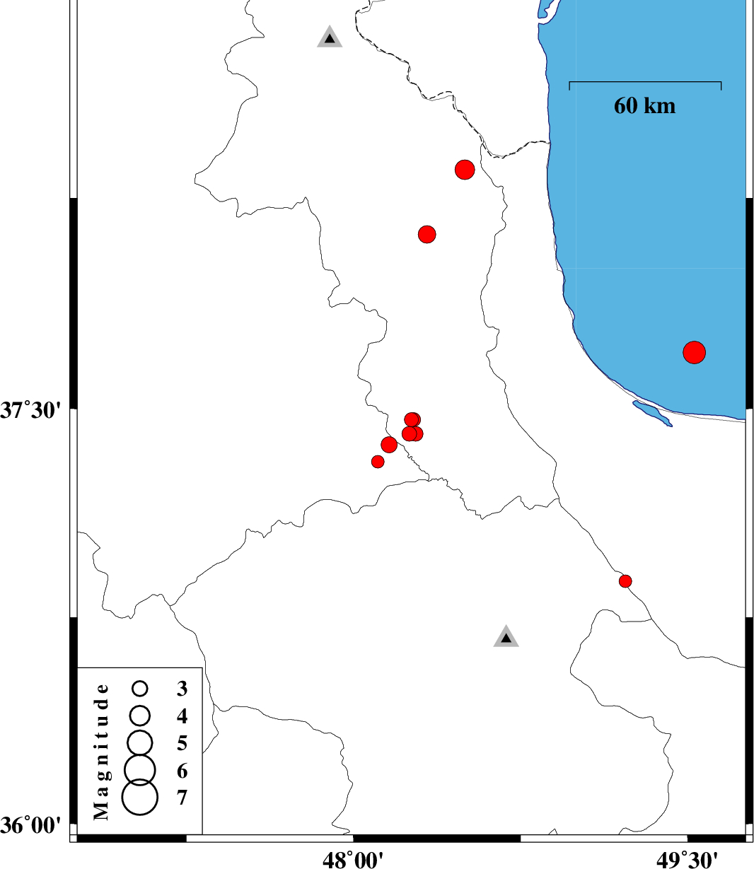
2012/02/25
|
00:46:03.9
|
04:16:03.9
| 37.46 | 48.26 | 15 |
ML:2.8
|
Ardebil Province, 28 km South-West of Givi | |
|
|
2012/02/09
|
12:01:18.3
|
15:31:18.3
| 37.41 | 48.25 | 14 |
ML:2.9
|
Ardebil Province, 34 km South-West of Givi | |
|
|
2012/02/09
|
05:53:58.5
|
09:23:58.5
| 37.31 | 48.11 | 14 |
ML:2.5
|
Azarbaijan Sharghi Province, 37 km South-East of Mianeh | |
|
|
2012/02/08
|
17:07:40.1
|
20:37:40.1
| 36.88 | 49.22 | 14 |
ML:2.6
|
Zanjan Province, 19 km West of Rudbar | |
|
|
2012/02/07
|
16:59:31.0
|
20:29:31.0
| 38.12 | 48.33 | 14 |
ML:3.5
|
Ardebil Province, 15 km South of Ardabil | |
|
|
2012/02/04
|
20:04:14.0
|
23:34:14.0
| 37.7 | 49.53 | 40 |
ML:4.5
|
Caspian Sea, 26 km North of Bandar-e anzali | |
|
|
2012/02/04
|
06:19:33.3
|
09:49:33.3
| 38.35 | 48.5 | 32 |
ML:3.9
|
Ardebil Province, 11 km Namin | |
|
|
2012/02/03
|
13:02:46.5
|
16:32:46.5
| 37.41 | 48.28 | 14 |
ML:2.9
|
Ardebil Province, 33 km South-West of Givi | |
|
|
2012/02/03
|
12:08:17.3
|
15:38:17.3
| 37.46 | 48.27 | 14 |
ML:2.8
|
Ardebil Province, 29 km South-West of Givi | |
|
|
2012/02/03
|
07:07:39.2
|
10:37:39.2
| 37.37 | 48.16 | 15 |
ML:3.3
|
Azarbaijan Sharghi Province, 40 km East of Mianeh | |
