
Magnitude |
:3.5 |
| Date & Time (UTC) | 2012-02-07 16:59:31.0 |
| Date & Time (Local) | 1390/11/18 20:29:31.0 |
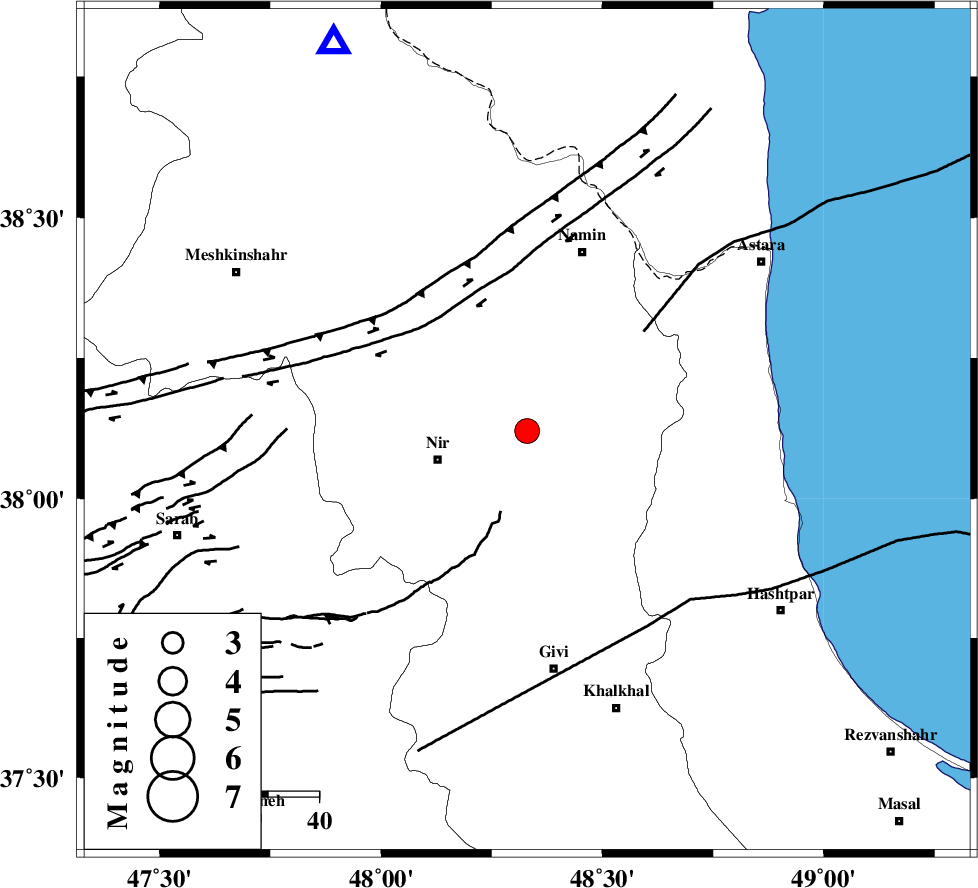
| Location | Lat:38.12 Lon: 48.33 |
| Region | Ardebil Province, 15 km South of Ardabil |
Nearest Cities |
|
| 7 km North of Mehmandust, Ardebil Province | |
| 11 km North West of Budalalu, Ardebil Province | |
| 14 km South of Ardabil, Ardebil Province | |
| 17 km North East of Rezaqoli qeshlaq, Ardebil Province | |
| 17 km South of Niar, Ardebil Province | |
| Depth | 14 km |
| Agency | |
Faults within 150 km: |
|
| SANGAVAR_F (Length: 61 km) , Distance to epicenter: 16 km | |
| BOZQUSH (Length: 70 km) , Distance to epicenter: 16 km | |
| TALESH_F (Length: 258 km) , Distance to epicenter: 51 km | |
| Number of Phases | 4 |
| RMS | 0.1 |
| Number of Stations | 4 |
| Error in Latitude | >4 km |
| Error in Longitude | 9.7 km |
| Error in Depth | 5.2 km |
Download waveform in seisan format
to download seisan software Click here
to access information about IIEES stations Click here
Amplitude | ||||||||
| UID | Agency | Station | Component | Amplitude | Period | Arrival Time | Proccessing Time | Signal Clip |
| 81796 | IIEES | GRMI | E | 3490.4 | 0.2 | 2012-02-07 16:59:56 | 2012-02-07 04:33:00 | n |
| 81797 | IIEES | GRMI | N | 2047.2 | 0.24 | 2012-02-07 17:00:00 | 2012-02-07 04:33:00 | n |
| 81798 | IIEES | ZNJK | N | 374.2 | 0.32 | 2012-02-07 17:00:23 | 2012-02-07 04:33:00 | n |
Phase | ||||||||||||
| Agency | Station | Component | Phase Type | Phase Quality | First Motion | Observed Arrival Time | Time Residual | Loc. Flag | Input Weight | Distance | Azimuth | |
| IIEES | GRMI | Z | Pg | E | 2012-02-07 16:59:45 | -0.06 | y | 85.5 | 334 | |||
| IIEES | ZNJK | Z | Pg | E | 2012-02-07 16:59:58 | -0.15 | y | 164 | 169 | |||
| IIEES | MAKU | Z | Pn | E | 2012-02-07 17:00:21 | 0.07 | y | 345 | 295 | |||
| IIEES | ASAO | Z | Pn | E | 2012-02-07 17:00:31 | 0.2 | y | 425 | 158 | |||