
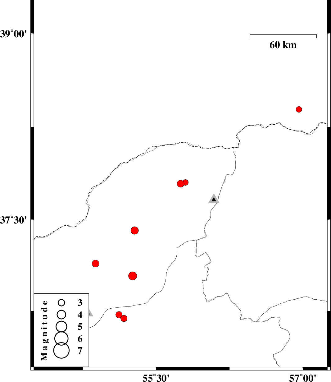
| Prel. Rep. | Date | Time(UTC) | Time(Local) | Lat. | Lon. | Depth | Mag. | Region | Waveform |
| 2011/12/15 | 17:20:28.9 | 20:50:28.9 | 37.79 | 55.75 | 18 | ML:3.2 | Golestan Province, 51 km North-East of Kalaleh | ||
| 2011/12/13 | 04:44:42.8 | 08:14:42.8 | 36.69 | 55.17 | 14 | ML:3 | Semnan Province, 36 km South of Ramian | ||
| 2011/12/11 | 15:21:19.4 | 18:51:19.4 | 37.04 | 55.26 | 17 | ML:3.8 | Golestan Province, 8 km Azadshahr | ||
| 2011/12/11 | 04:17:20.9 | 07:47:20.9 | 38.39 | 56.96 | 6 | ML:2.7 | Turkmenistan, 94 km North of Ashkhaneh | ||
| 2011/12/04 | 08:48:39.0 | 12:18:39.0 | 37.41 | 55.28 | 16 | ML:3.5 | Golestan Province, 19 km West of Kalaleh | ||
| 2011/12/01 | 03:56:42.1 | 07:26:42.1 | 37.8 | 55.8 | 6 | ML:2.7 | Golestan Province, 54 km North-East of Kalaleh | ||
| 2011/11/26 | 12:04:55.2 | 15:34:55.2 | 37.14 | 54.88 | 27 | ML:3.2 | Golestan Province, 26 km North of Ali Abad | ||
| 2011/11/21 | 21:39:46.1 | 01:09:46.1 | 36.72 | 55.12 | 42 | ML:3 | Semnan Province, 33 km South of Ramian |