
| Prel. Rep. | Date | Time(UTC) | Time(Local) | Lat. | Lon. | Depth | Mag. | Region | Waveform |
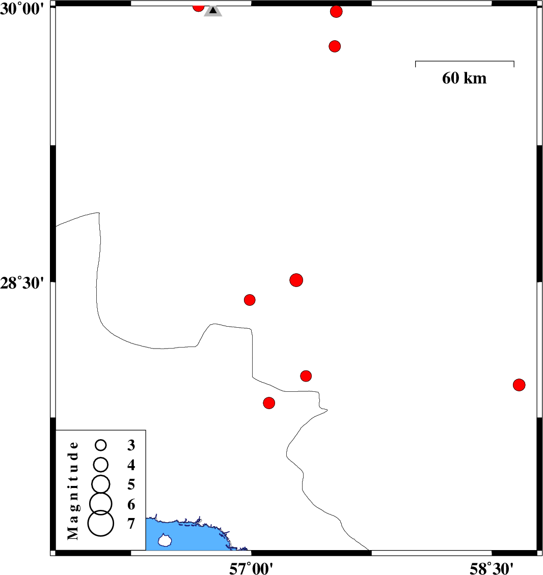
| 2011/07/21 | 03:25:33.0 | 07:55:33.0 | 28.51 | 57.28 | 18 | ML:3.6 | Kerman Province, 48 km South-West of Jiroft | ||
| 2011/07/17 | 19:46:44.0 | 00:16:44.0 | 27.83 | 57.11 | 21 | ML:3.2 | Hormozgan Province, 47 km North-West of Dehbarez | ||
| 2011/07/10 | 13:08:55.5 | 17:38:55.5 | 29.98 | 57.53 | 14 | ML:3.4 | Kerman Province, 55 km South-East of Kerman | ||
| 2011/07/09 | 06:47:39.3 | 11:17:39.3 | 30.01 | 56.67 | 26 | ML:3.3 | Kerman Province, 13 km Bardsir | ||
| 2011/07/04 | 07:46:27.2 | 12:16:27.2 | 27.93 | 58.67 | 14 | ML:3.4 | Kerman Province, 96 km East of Kahnuj | ||
| 2011/06/26 | 19:01:35.4 | 23:31:35.4 | 27.41 | 55.9 | 14 | ML:2.9 | Hormozgan Province, 45 km North-West of Bandar-e abbas | ||
| 2011/06/26 | 09:50:28.0 | 14:20:28.0 | 29.79 | 57.52 | 9 | ML:3.3 | Kerman Province, 70 km South-East of Kerman | ||
| 2011/06/21 | 21:29:45.1 | 01:59:45.1 | 27.98 | 57.34 | 18 | ML:3.1 | Kerman Province, 35 km West of Kahnuj | ||
| 2011/06/21 | 02:08:11.5 | 06:38:11.5 | 28.4 | 56.99 | 15 | ML:3.1 | Kerman Province, 80 km South-West of Jiroft |