
Magnitude |
:3.4 |
| Date & Time (UTC) | 2011-07-04 07:46:27.2 |
| Date & Time (Local) | 1390/4/13 12:16:27.2 |
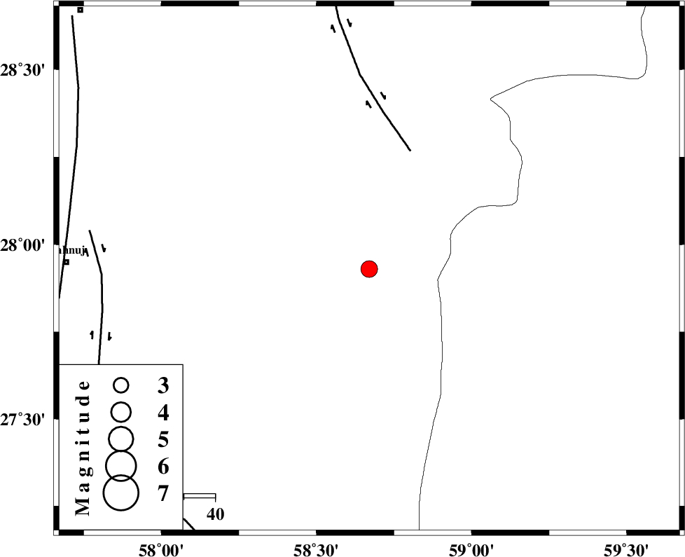
| Location | Lat:27.93 Lon: 58.67 |
| Region | Kerman Province, 96 km East of Kahnuj |
Nearest Cities |
|
| 19 km East of Borj-e abbasabad, Kerman Province | |
| 67 km South East of Mardehak, Kerman Province | |
| 89 km South West of Mohammadabad-e gonbaki, Kerman Province | |
| 89 km South East of Dosari, Kerman Province | |
| 90 km North East of Qalehy-eganj, Kerman Province | |
| Depth | 14 km |
| Agency | |
Faults within 150 km: |
|
| BAM_F (Length: 118 km) , Distance to epicenter: 40 km | |
| JIROFT_F (Length: 144 km) , Distance to epicenter: 85 km | |
| SABZEVARAN_F (Length: 190 km) , Distance to epicenter: 96 km | |
| Number of Phases | 4 |
| RMS | 0.1 |
| Number of Stations | 4 |
| Error in Latitude | >3.4 km |
| Error in Longitude | 4.5 km |
| Error in Depth | 9.5 km |
Download waveform in seisan format
to download seisan software Click here
to access information about IIEES stations Click here
Amplitude | ||||||||
| UID | Agency | Station | Component | Amplitude | Period | Arrival Time | Proccessing Time | Signal Clip |
| 79535 | IIEES | BNDS | N | 124.4 | 0.43 | 2011-07-04 07:47:51 | 2011-07-04 08:31:00 | n |
| 79536 | IIEES | ZHSF | N | 155.7 | 0.44 | 2011-07-04 07:47:41 | 2011-07-04 08:31:00 | n |
| 79537 | IIEES | KRBR | N | 194.5 | 0.26 | 2011-07-04 07:47:51 | 2011-07-04 08:31:00 | n |
| 79538 | IIEES | KRBR | E | 213.3 | 0.2 | 2011-07-04 07:47:56 | 2011-07-04 08:31:00 | n |
Phase | ||||||||||||
| Agency | Station | Component | Phase Type | Phase Quality | First Motion | Observed Arrival Time | Time Residual | Loc. Flag | Input Weight | Distance | Azimuth | |
| IIEES | ZHSF | Z | P | E | 2011-07-04 07:47:09 | 0 | y | 277 | 47 | |||
| IIEES | KRBR | Z | Pn | E | 2011-07-04 07:47:11 | 0.22 | y | 294 | 321 | |||
| IIEES | KRBR | N | Sg | E | 2011-07-04 07:47:50 | -0.13 | y | 294 | 321 | |||
| IIEES | CHBR | Z | Pn | E | 2011-07-04 07:47:13 | -0.08 | y | 315 | 145 | |||