
Magnitude |
:3.3 |
| Date & Time (UTC) | 2011-07-09 06:47:39.3 |
| Date & Time (Local) | 1390/4/18 11:17:39.3 |
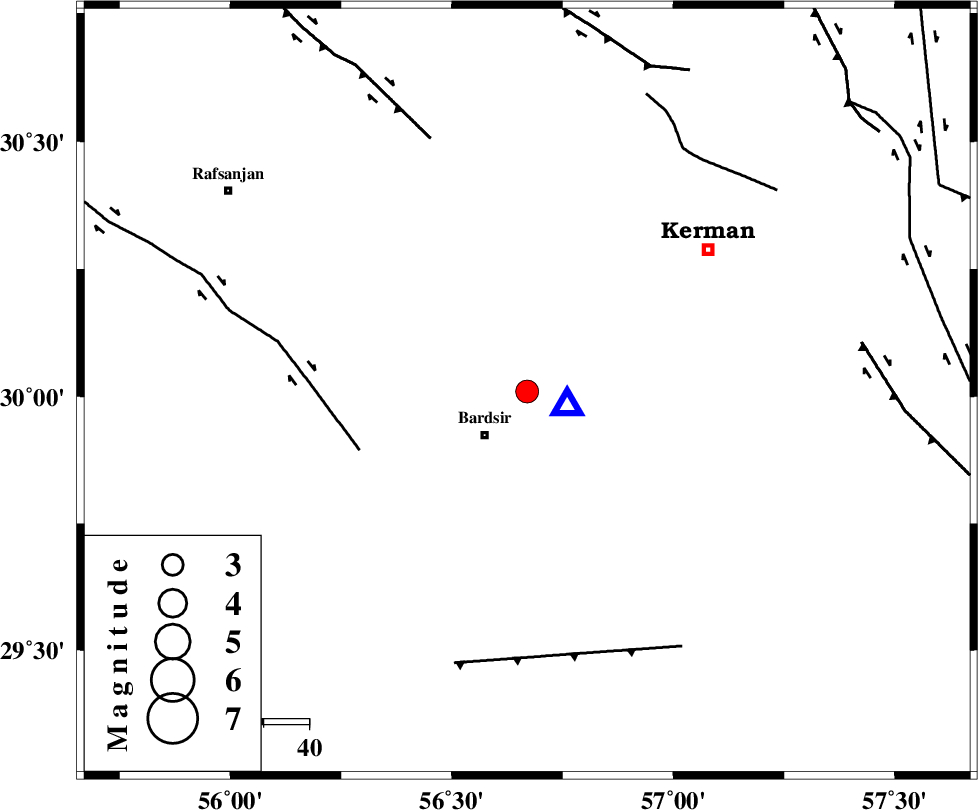
| Location | Lat:30.01 Lon: 56.67 |
| Region | Kerman Province, 13 km Bardsir |
Nearest Cities |
|
| 11 km North of Dashtkar, Kerman Province | |
| 13 km North of Bardsir, Kerman Province | |
| 21 km North West of Negar, Kerman Province | |
| 23 km South West of Baghin, Kerman Province | |
| 27 km North East of Mahutak, Kerman Province | |
| Depth | 26 km |
| Agency | |
Faults within 150 km: |
|
| RAFSANJAN_F (Length: 129 km) , Distance to epicenter: 39 km | |
| DARIVAN_F (Length: 131 km) , Distance to epicenter: 59 km | |
| LALEHZAR_F (Length: 52 km) , Distance to epicenter: 62 km | |
| Number of Phases | 7 |
| RMS | 0.1 |
| Number of Stations | 6 |
| Error in Latitude | >1.7 km |
| Error in Longitude | 2.3 km |
| Error in Depth | 1.8 km |
Download waveform in seisan format
to download seisan software Click here
to access information about IIEES stations Click here
Amplitude | ||||||||
| UID | Agency | Station | Component | Amplitude | Period | Arrival Time | Proccessing Time | Signal Clip |
| 79617 | IIEES | KRBR | N | 6677.2 | 0.2 | 2011-07-09 06:47:49 | 2011-07-09 07:12:00 | n |
| 79618 | IIEES | KRBR | E | 6470 | 0.2 | 2011-07-09 06:47:50 | 2011-07-09 07:12:00 | n |
| 79619 | IIEES | TABS | E | 26.3 | 0.49 | 2011-07-09 06:49:38 | 2011-07-09 07:12:00 | n |
| 79620 | IIEES | NASN | E | 32.4 | 0.57 | 2011-07-09 06:49:59 | 2011-07-09 07:12:00 | n |
Phase | ||||||||||||
| Agency | Station | Component | Phase Type | Phase Quality | First Motion | Observed Arrival Time | Time Residual | Loc. Flag | Input Weight | Distance | Azimuth | |
| IIEES | KRBR | Z | Pg | E | 2011-07-09 06:47:44 | -0.04 | y | 9.57 | 110 | |||
| IIEES | BNDS | Z | Pn | E | 2011-07-09 06:48:22 | 0.06 | y | 294 | 190 | |||
| IIEES | TABS | Z | Pn | E | 2011-07-09 06:48:36 | 0.05 | y | 406 | 6 | |||
| IIEES | NASN | Z | Pn | E | 2011-07-09 06:48:45 | -0.23 | y | 480 | 311 | |||
| IIEES | NASN | N | Sg | E | 2011-07-09 06:49:50 | 0.13 | y | 480 | 311 | |||
| IIEES | SHRT | Z | Pn | E | 2011-07-09 06:48:51 | 0.1 | y | 529 | 39 | |||
| IIEES | SHRO | Z | Pn | E | 2011-07-09 06:49:08 | -0.11 | y | 668 | 355 | |||