
| Prel. Rep. | Date | Time(UTC) | Time(Local) | Lat. | Lon. | Depth | Mag. | Region | Waveform |
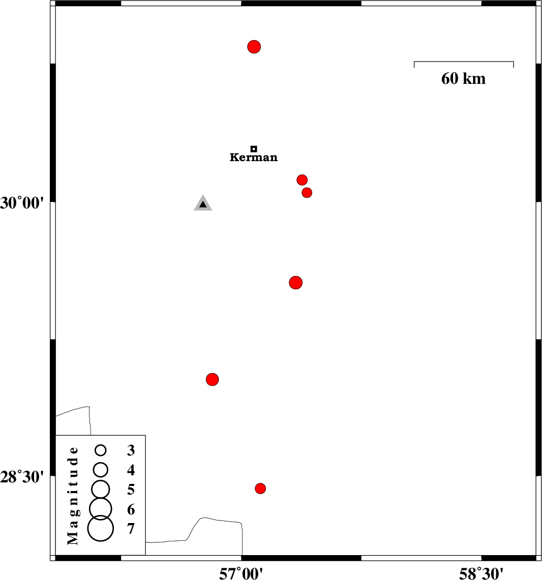
| 2011/05/14 | 11:39:27.5 | 16:09:27.5 | 29.56 | 57.34 | 11 | ML:3.7 | Kerman Province, 85 km South-East of Kerman | ||
| 2011/05/12 | 18:45:56.8 | 23:15:56.8 | 29.03 | 56.82 | 30 | ML:3.5 | Kerman Province, 31 km South-East of Baft | ||
| 2011/05/11 | 20:48:03.8 | 01:18:03.8 | 30.05 | 57.41 | 6 | ML:2.8 | Kerman Province, 41 km South-East of Kerman | ||
| 2011/05/11 | 20:14:48.5 | 00:44:48.5 | 30.12 | 57.38 | 6 | ML:3 | Kerman Province, 35 km South-East of Kerman | ||
| 2011/05/07 | 14:15:56.8 | 18:45:56.8 | 28.43 | 57.12 | 15 | ML:3 | Kerman Province, 66 km South-West of Jiroft | ||
| 2011/05/02 | 19:40:07.5 | 00:10:07.5 | 28.29 | 56.08 | 14 | ML:3 | Kerman Province, 17 km East of Hajiabad | ||
| 2011/04/30 | 08:55:13.2 | 13:25:13.2 | 30.84 | 57.08 | 14 | ML:3.7 | Kerman Province, 49 km East of Zarand |