
Magnitude |
:3 |
| Date & Time (UTC) | 2011-05-07 14:15:56.8 |
| Date & Time (Local) | 1390/2/17 18:45:56.8 |
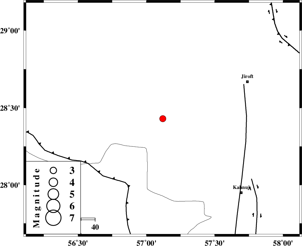
| Location | Lat:28.43 Lon: 57.12 |
| Region | Kerman Province, 66 km South-West of Jiroft |
Nearest Cities |
|
| 26 km North East of Sarkhan, Kerman Province | |
| 32 km South of Dolatabad, Kerman Province | |
| 32 km North West of Hurpasefid, Kerman Province | |
| 43 km North West of Faryab, Kerman Province | |
| 47 km North West of Mehrueye-e paeen, Kerman Province | |
| Depth | 15 km |
| Agency | |
Faults within 150 km: |
|
| MAIN_ZAGROS_R_F (Length: 1106 km) , Distance to epicenter: 53 km | |
| SABZEVARAN_F (Length: 190 km) , Distance to epicenter: 60 km | |
| JIROFT_F (Length: 144 km) , Distance to epicenter: 77 km | |
| Number of Phases | 3 |
| RMS | 0 |
| Number of Stations | 3 |
| Error in Latitude | >2.5 km |
| Error in Longitude | 8.5 km |
| Error in Depth | 0 km |
Download waveform in seisan format
to download seisan software Click here
to access information about IIEES stations Click here
Amplitude | ||||||||
| UID | Agency | Station | Component | Amplitude | Period | Arrival Time | Proccessing Time | Signal Clip |
| 78885 | IIEES | BNDS | N | 212.3 | 0.41 | 2011-05-07 14:16:41 | 2011-05-07 02:52:00 | n |
| 78886 | IIEES | BNDS | E | 423.9 | 0.62 | 2011-05-07 14:16:41 | 2011-05-07 02:52:00 | n |
| 78887 | IIEES | KRBR | E | 161.3 | 0.32 | 2011-05-07 14:16:56 | 2011-05-07 02:52:00 | n |
Phase | ||||||||||||
| Agency | Station | Component | Phase Type | Phase Quality | First Motion | Observed Arrival Time | Time Residual | Loc. Flag | Input Weight | Distance | Azimuth | |
| IIEES | BNDS | Z | Pg | E | 2011-05-07 14:16:21 | 0 | y | 148 | 220 | |||
| IIEES | KRBR | Z | Pg | E | 2011-05-07 14:16:25 | 0 | y | 176 | 349 | |||
| IIEES | GHIR | Z | Pn | E | 2011-05-07 14:16:54 | 0 | y | 406 | 269 | |||