
Magnitude |
:2.8 |
| Date & Time (UTC) | 2011-05-11 20:48:03.8 |
| Date & Time (Local) | 1390/2/22 01:18:03.8 |
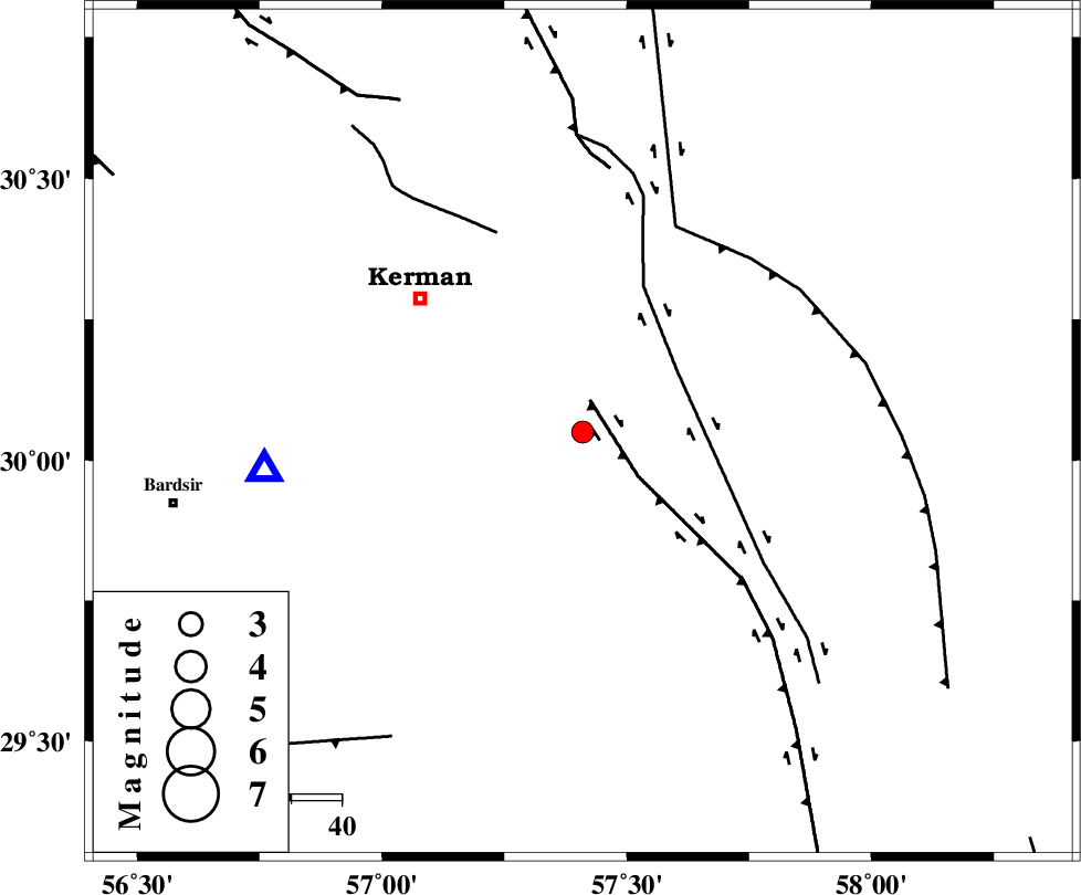
| Location | Lat:30.05 Lon: 57.41 |
| Region | Kerman Province, 41 km South-East of Kerman |
Nearest Cities |
|
| 12 km North East of Mahan, Kerman Province | |
| 12 km East of Langar, Kerman Province | |
| 17 km East of Mohiabad, Kerman Province | |
| 21 km West of Jushan, Kerman Province | |
| 22 km South West of Sirch, Kerman Province | |
| Depth | 6 km |
| Agency | |
Faults within 150 km: |
|
| GOWK_F (Length: 152 km) , Distance to epicenter: 7 km | |
| GOLBAF_SIRCH_F (Length: 114 km) , Distance to epicenter: 22 km | |
| CHATRUD_F (Length: 37 km) , Distance to epicenter: 43 km | |
| Number of Phases | 4 |
| RMS | 0.1 |
| Number of Stations | 3 |
| Error in Latitude | >6.8 km |
| Error in Longitude | 4.3 km |
| Error in Depth | 8.3 km |
Download waveform in seisan format
to download seisan software Click here
to access information about IIEES stations Click here
Amplitude | ||||||||
| UID | Agency | Station | Component | Amplitude | Period | Arrival Time | Proccessing Time | Signal Clip |
| 78916 | IIEES | KRBR | N | 587.1 | 0.44 | 2011-05-11 20:48:24 | 2011-05-11 09:51:00 | n |
Phase | ||||||||||||
| Agency | Station | Component | Phase Type | Phase Quality | First Motion | Observed Arrival Time | Time Residual | Loc. Flag | Input Weight | Distance | Azimuth | |
| IIEES | KRBR | Z | P | E | 2011-05-11 20:48:14 | -0.1 | y | 62.8 | 263 | |||
| IIEES | KRBR | N | Sg | E | 2011-05-11 20:48:24 | 0.1 | y | 62.8 | 263 | |||
| IIEES | BNDS | Z | Pn | E | 2011-05-11 20:48:52 | 0 | y | 318 | 203 | |||
| IIEES | ZHSF | Z | Pn | E | 2011-05-11 20:48:53 | 0.1 | y | 329 | 98 | |||