
| Prel. Rep. | Date | Time(UTC) | Time(Local) | Lat. | Lon. | Depth | Mag. | Region | Waveform |
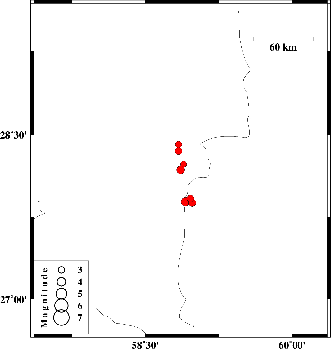
| 2011/04/11 | 16:47:57.6 | 21:17:57.6 | 27.92 | 58.96 | 15 | ML:3.3 | Sistan va Baloochestan Province, 125 km East of Kahnuj | ||
| 2011/04/11 | 16:45:07.3 | 21:15:07.3 | 27.88 | 58.98 | 15 | ML:3.4 | Sistan va Baloochestan Province, 126 km East of Kahnuj | ||
| 2011/04/11 | 12:02:15.3 | 16:32:15.3 | 27.89 | 58.91 | 15 | ML:4 | Sistan va Baloochestan Province, 120 km East of Kahnuj | ||
| 2011/04/11 | 02:12:51.2 | 06:42:51.2 | 28.18 | 58.86 | 14 | ML:3.7 | Kerman Province, 117 km North-East of Kahnuj | ||
| 2011/04/09 | 19:55:57.6 | 00:25:57.6 | 28.41 | 58.84 | 14 | ML:2.9 | Kerman Province, 92 km South-East of Bam | ||
| 2011/04/04 | 19:34:51.4 | 00:04:51.4 | 28.23 | 58.89 | 14 | ML:2.8 | Kerman Province, 111 km South-East of Bam | ||
| 2011/04/04 | 09:17:31.7 | 13:47:31.7 | 28.35 | 58.84 | 15 | ML:3.3 | Kerman Province, 97 km South-East of Bam |