
Magnitude |
:3.4 |
| Date & Time (UTC) | 2011-04-11 16:45:07.3 |
| Date & Time (Local) | 1390/1/22 21:15:07.3 |
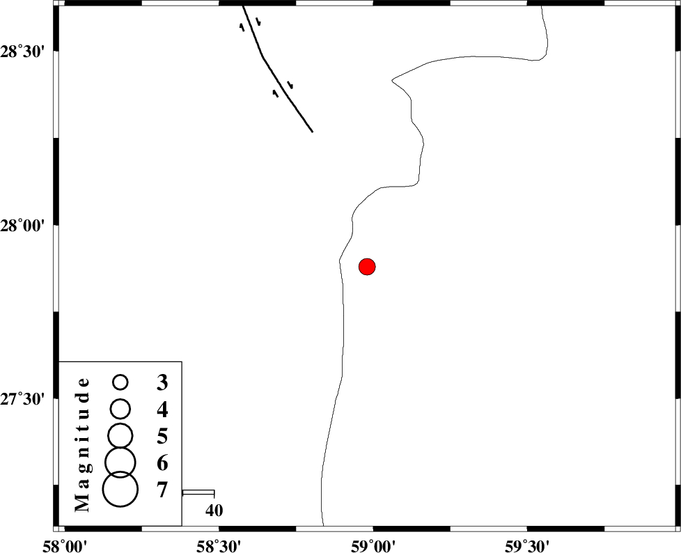
| Location | Lat:27.88 Lon: 58.98 |
| Region | Sistan va Baloochestan Province, 126 km East of Kahnuj |
Nearest Cities |
|
| 48 km South East of Borj-e abbasabad, Kerman Province | |
| 65 km North West of Kalemursi, Sistan va Baloochestan Province | |
| 92 km South of Hoseynabad, Kerman Province | |
| 93 km South East of Mohammadabad-e gonbaki, Kerman Province | |
| 95 km South East of Mardehak, Kerman Province | |
| Depth | 15 km |
| Agency | |
Faults within 150 km: |
|
| BAM_F (Length: 118 km) , Distance to epicenter: 46 km | |
| S_JAZMURIAN_F (Length: 91 km) , Distance to epicenter: 110 km | |
| JIROFT_F (Length: 144 km) , Distance to epicenter: 112 km | |
| Number of Phases | 4 |
| RMS | 0.4 |
| Number of Stations | 4 |
| Error in Latitude | >6.6 km |
| Error in Longitude | 4.7 km |
| Error in Depth | 0 km |
Download waveform in seisan format
to download seisan software Click here
to access information about IIEES stations Click here
Amplitude | ||||||||
| UID | Agency | Station | Component | Amplitude | Period | Arrival Time | Proccessing Time | Signal Clip |
| 78678 | IIEES | BNDS | E | 157.6 | 0.4 | 2011-04-11 16:46:28 | 2011-04-11 05:06:00 | n |
| 78679 | IIEES | BNDS | N | 270.1 | 0.44 | 2011-04-11 16:46:33 | 2011-04-11 05:06:00 | n |
| 78680 | IIEES | KRBR | N | 106.4 | 0.68 | 2011-04-11 16:46:32 | 2011-04-11 05:06:00 | n |
| 78681 | IIEES | KRBR | E | 143.8 | 0.6 | 2011-04-11 16:46:33 | 2011-04-11 05:06:00 | n |
Phase | ||||||||||||
| Agency | Station | Component | Phase Type | Phase Quality | First Motion | Observed Arrival Time | Time Residual | Loc. Flag | Input Weight | Distance | Azimuth | |
| IIEES | ZHSF | N | Pn | E | 2011-04-11 16:45:47 | 0.3 | y | 260 | 42 | |||
| IIEES | BNDS | Z | Pn | E | 2011-04-11 16:45:50 | 0.4 | y | 282 | 260 | |||
| IIEES | CHBR | Z | Pn | E | 2011-04-11 16:45:51 | -0.2 | y | 294 | 149 | |||
| IIEES | KRBR | N | Pn | E | 2011-04-11 16:45:54 | -0.5 | y | 318 | 318 | |||